The daruma dolls as featured above are a type of prayer dolls that are a speciality to Takasaki. When you buy them neither of the pupils have been painted. Your job is to paint a pupil in the left eye of the doll, then make a wish or set yourself a goal for the coming year. One year after buying the doll you have to bring it back to the temple where it was purchased and have a priest burn it as an offering. This is regardless of if your wish was granted or not. The main temple for this business is the Shorinzan Daruma-Ji temple which is a couple of kilometres east of Takasaki, closer to Itahana-shuku. Takasaki styles itself as “Lucky town” nowadays because of the daruma doll business.
The road to Takasaki from Honjō crosses several important rivers from a Nakasendō perspective. Both the Kanna and the Karasu rivers posed serious problems for travellers during the Edo period. First, they tended to flood often and often disastrously, and second, because of the paranoia of the ruling Tokugawa clan neither of them had bridges that went all the way across. This was supposed to make it more difficult to march armies towards Edo as small boats shuffling people across a river isn’t exactly efficient in larger numbers.
Both the Kanna and the Karasu rivers are part of the huge Tone river system that flow from the central mountains towards the Pacific ocean. The Karasu might seem like a larger river, but it’s not particularly deep. I witnessed a couple of guys in wellies up to their hips walk across the whole river! They seemed to be taking water samples. The Nakasendō crossed this river somewhere in this picture, but none of the piers or anything is left to show for this.
Shinmachi-shuku was important as the landing place for people crossing the Kanna river from the south, and for people waiting cross when coming from the other direction. Today the bridge across the river is the border between the Saitama and the Gunma prefectures.
Kuragano-shuku has a few buildings left, and they also have a kōsatsu which I think is the first example along the path this far. The kōsatsu were sign boards where the shōgun’s proclamations and other legal information could be posted. They were also called seisatsu. This particular message board is a replica, however, as the original was torn down in the early 20th century.
Kuragano-shuku was also the starting place for the minor, but still important road Nikkō Reiheishi Kaidō, which ran towards Nikkō.
Takasaki-shuku doesn’t have much of anything to show for having been a post town during the Edo period. It does however have the grave of a disgraced grandson of Tokugawa Ieasu himself, Tokugawa Tadanaga who had to commit suicide after having alledgedly committed countless acts of violence and debauchery. The temple where his grave is was unfortunately closed when I tried to visit.
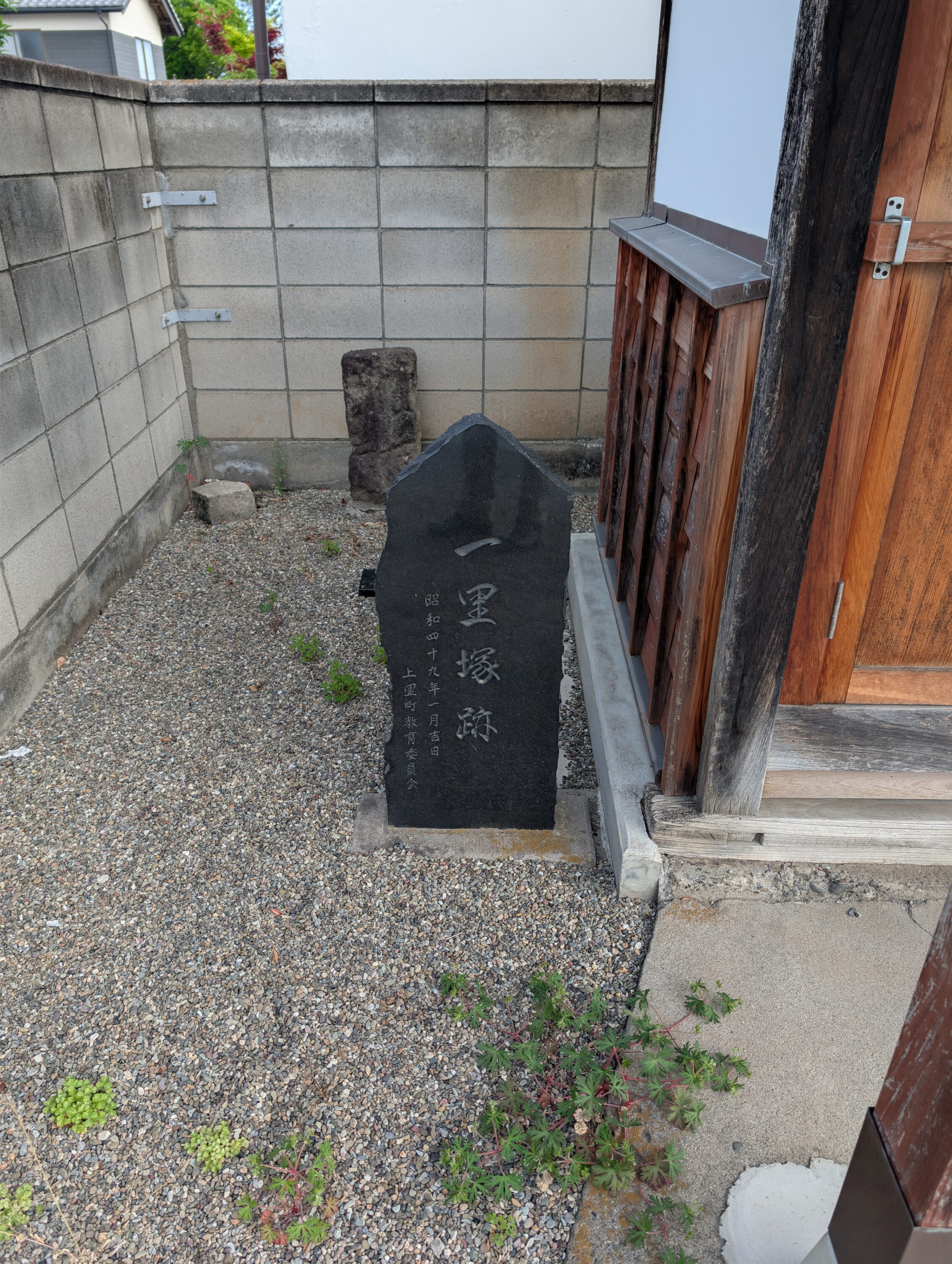
Ichirizuka along the path today.
Mannenji ichirizuka – gone the way of the parrot.
Katsuba ichirizuka – a small stone marker shows where this milestone used to be. The stone is right next to a small shrine on the right side of the path. Also, if there are any bricklayers or masons reading this, if you look at the corner between the two low walls in the background, wouldn’t it be a much better and more stable construction to use some form of overlap between the bricks of each wall instead of using the brackets? Or is this an earthhquake thing?
Nakajima ichirizuka – gone since before the Meiji era because of floods, and no signs today.
Kuragano ichirizuka – destroyed, but there’s a small sign in a flower bed right next to the road.
Takasaki ichirizuka – destroyed, exact location unknown, but there is a sign that is waaayyy off where it ought to have been on the next leg of the path. But even then, the sign is not even close to the path.
Total distance hiked today according to the map: 18.8
Total distance hiked today according to my fitness app: 24.2 km.


Leave a Reply