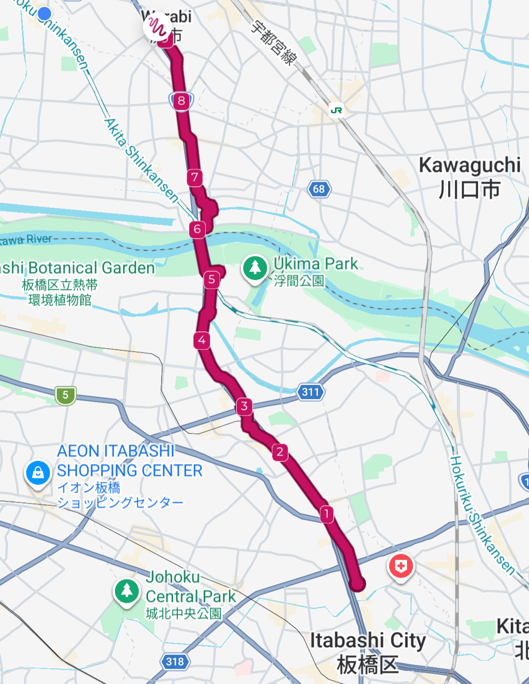
The second leg of the Nakasendō from Itabashi-shuku to Warabi-shuku keeps following the National Route 17, albeit still with a lot of sidetracking along parallel streets. The path crosses three rivers, including the mighty Arakawa, and enters the Saitama prefecture, effectively leaving Tokyo behind. You wouldn’t know it happened unless you read the signs though. The city just keeps going.
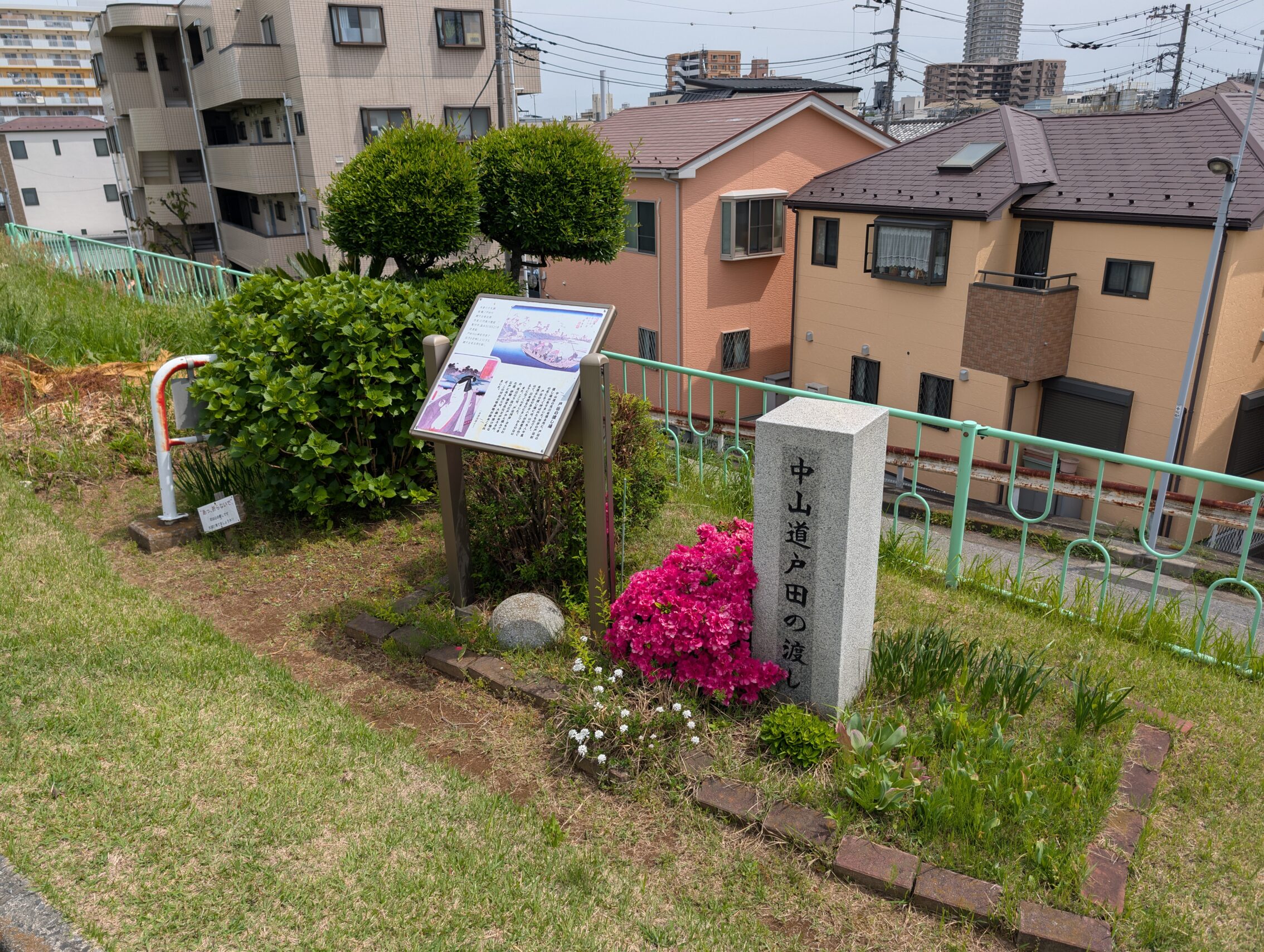
The path makes a handful of very weird turns, especially around the Arakawa crossing. Back in the day there was no bridge across this river, and travellers had to make do with a ferry crossing. The boats moored a bit east of the current bridges on both sides of the river, and if you want to follow the old Nakasendō as closely as possible, you need to to make some weird choices here and there. See the post The Layout of the Path for a more detailed description of this.
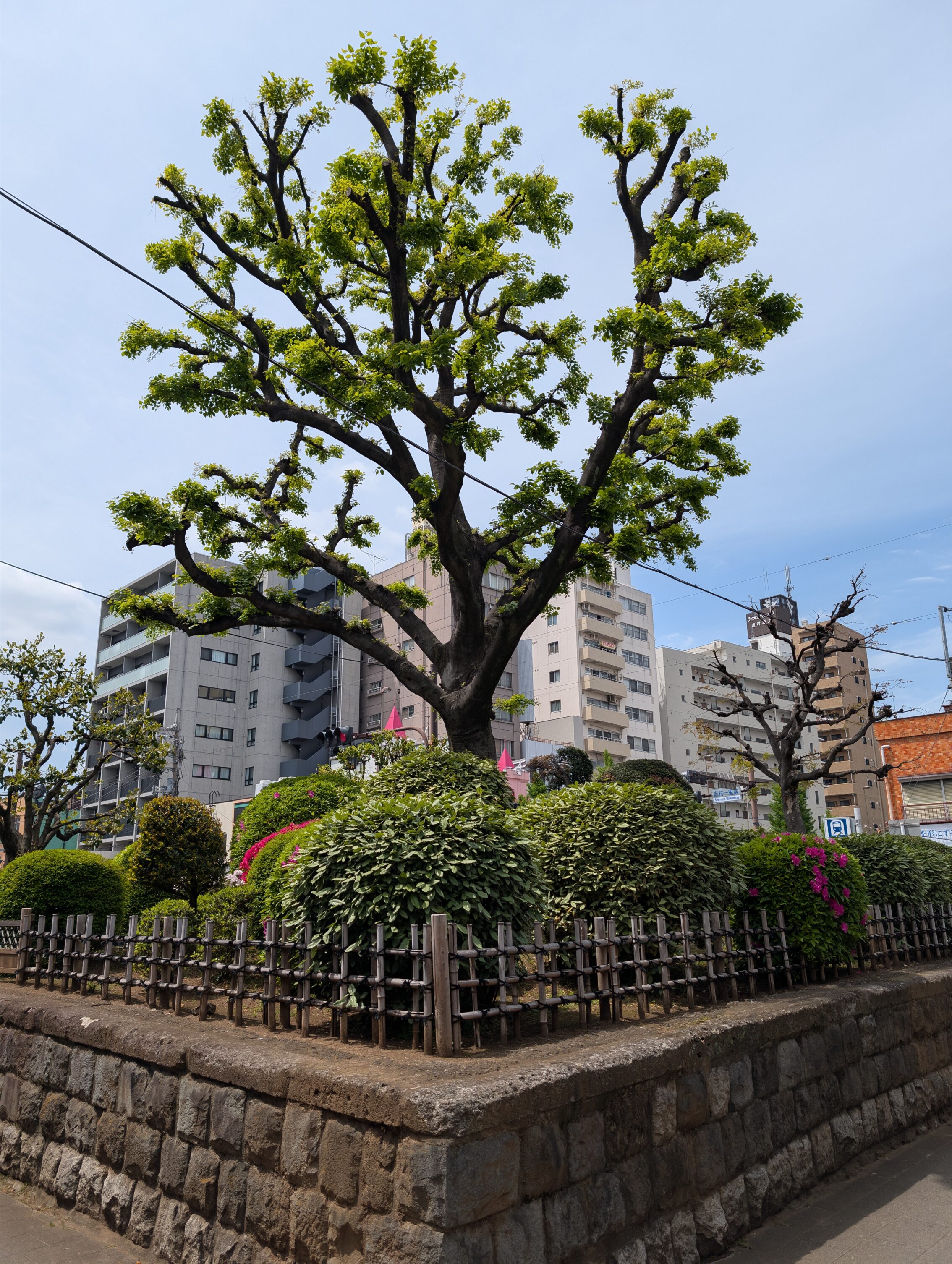
At around the 2 kilometre mark is the famous Shimura Ichirizuka, the third from Nihonbashi. As with most milestones along the path, this was destined for destruction a little over a century ago, but was saved because of a resurgence of understanding the importance of history (and also increased nationalism). The milestone was designated a National Historic Site of Japan in 1922. Both mounds are still intact, and one of the reasons for this is that they were already set very far apart, and could accommodate a wider road necessary for modern traffic. In the photo, you can see both trees, and the one on the right is on the other side of the road.
There is nothing left of the original piers and docking places for crossing the Arakawa, but you can find stone markers and information signs on both sides of the river where these things were, at least approximately.
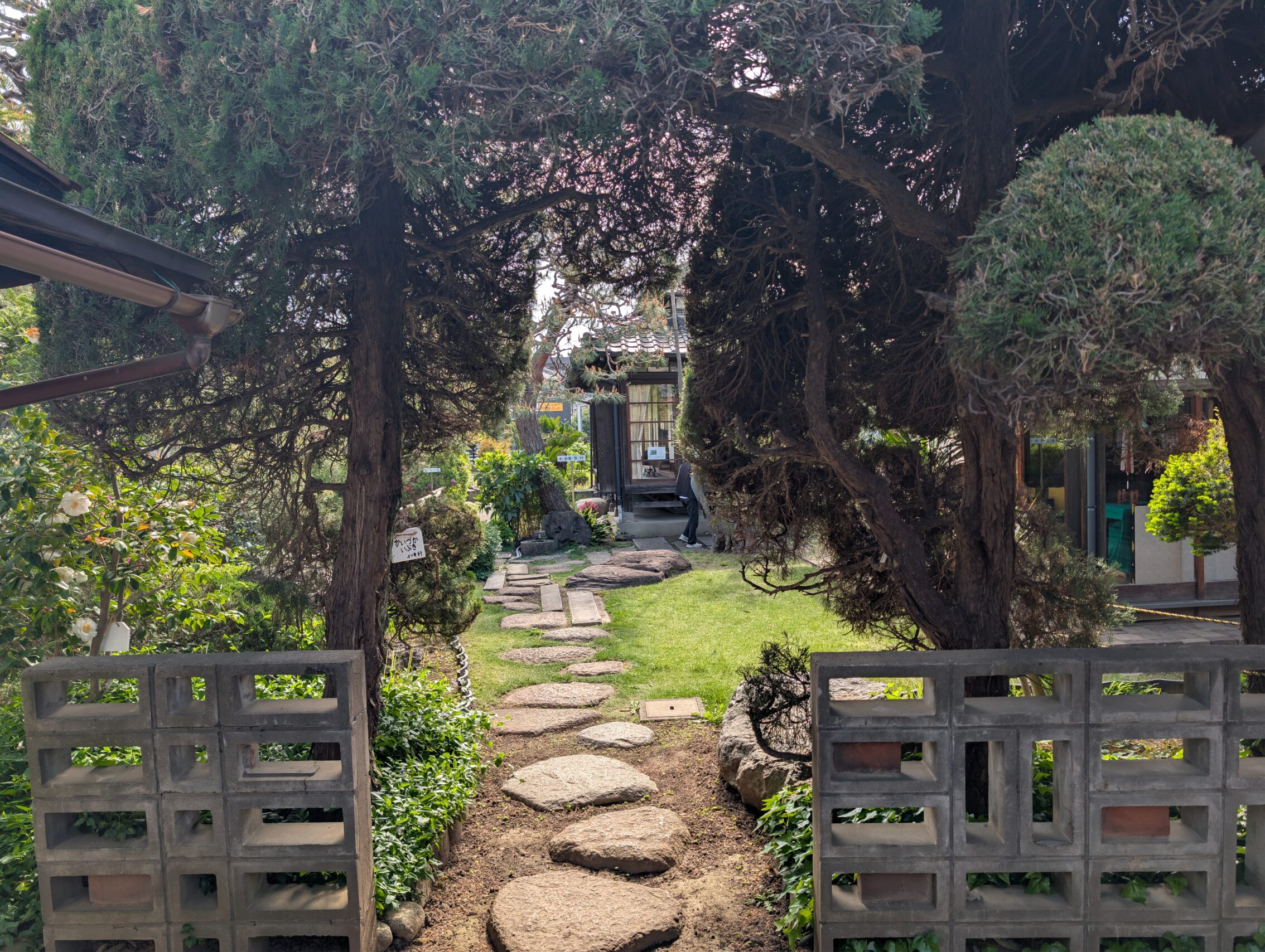
Warabi-shuku is a very nice place to visit. There are a couple of period-typical buildings left among all the new stuff, as well as the Warabi history and folklore museum. It is housed in a couple of said Edo-period buildings and they try to showcase what life was like back then. One of the houses has a lovely garden with a pond, in addition to the house itself.
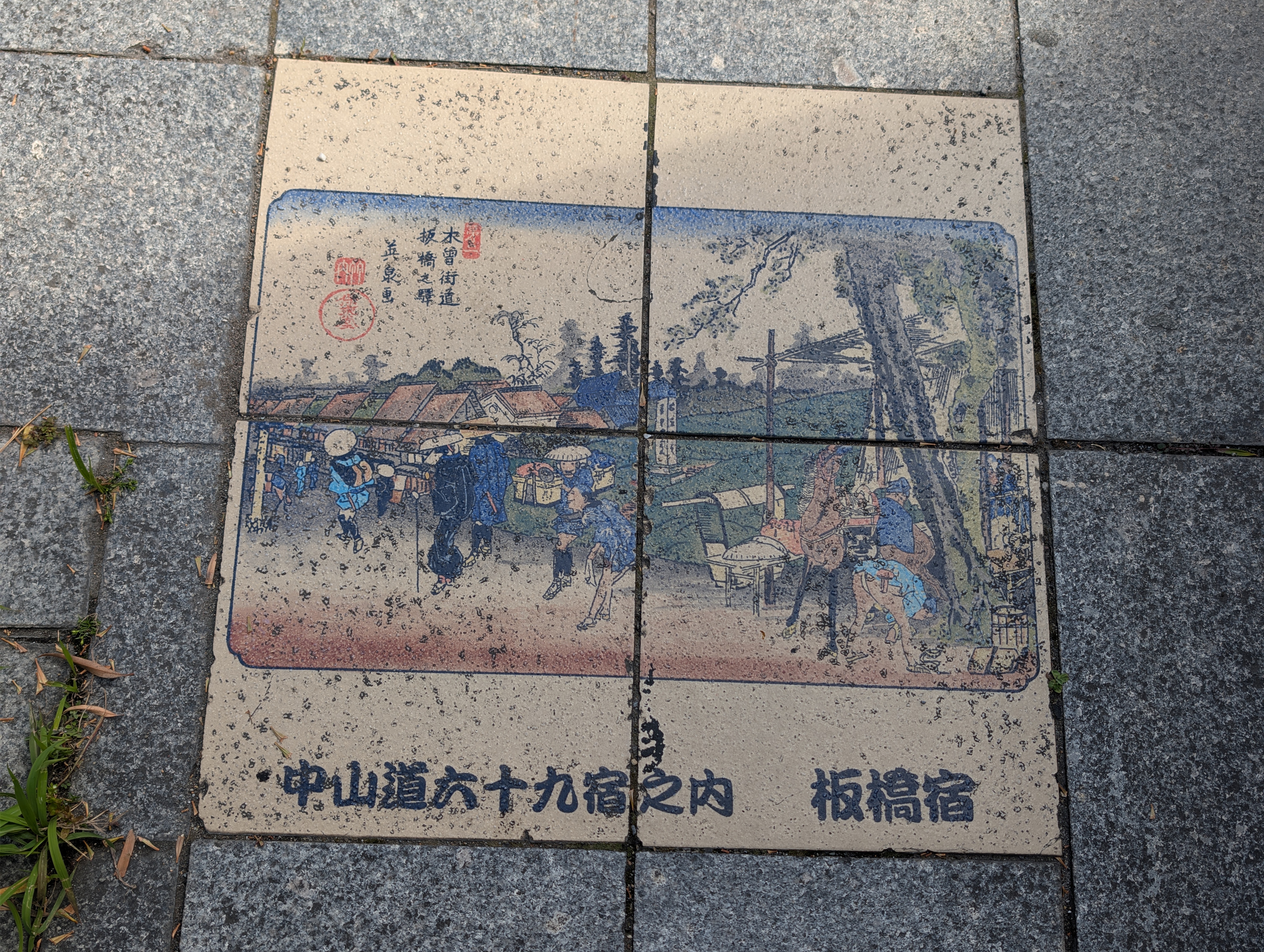
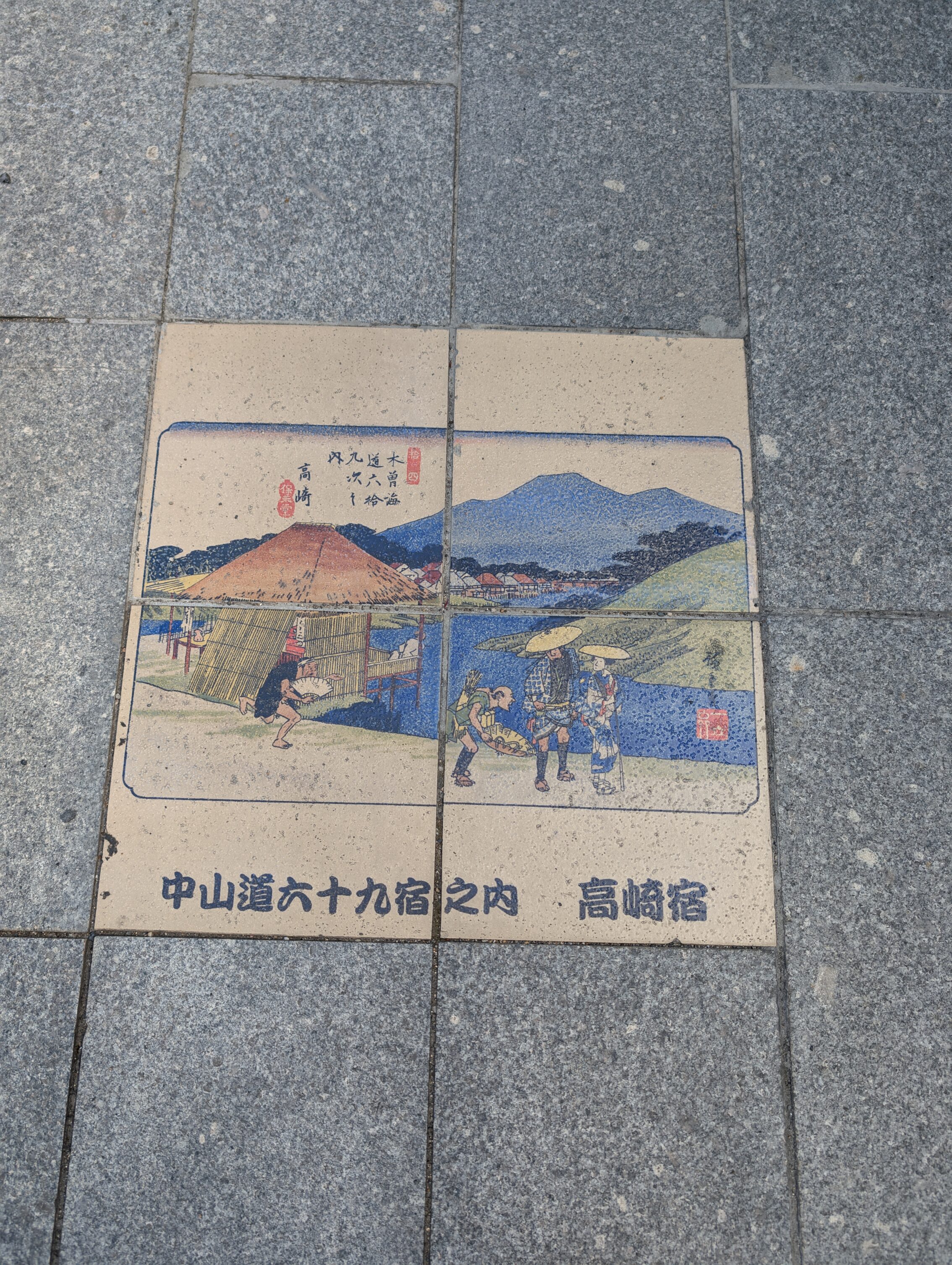
Finally, the local government have put in stones with pictures on them in the pavement on both sides of the street that ran through the Warabi shukuba. These stones depict the illustrations from the book The Sixty-nine Stations of the Kiso Kaidō, which was a series of woodcuts created by Utagawa Hiroshige and Keisai Eisen and published between 1834 and 1842. The book contained one illustration for each of the 69 post stations, except Nakatsgawa-juku which has two. Each illustration of a post town has it’s own stones in the pavement all along the street.
Total distance hiked today according to the map, including getting to the hotel: 22.8 km
Total distance hiked today according to fitness app: 23.8 km.
Tomorrow I’ll tackle four shorter legs of the journey, starting from Warabi-shuku, via Urawa-shuku, Ōmiya-shuku, Ageo-shuku and finally Okegawa-shuku. All of these are also on the Kantō Plain where I started off back in Tokyo, so I don’t expect a lot of hills just yet.


Leave a Reply