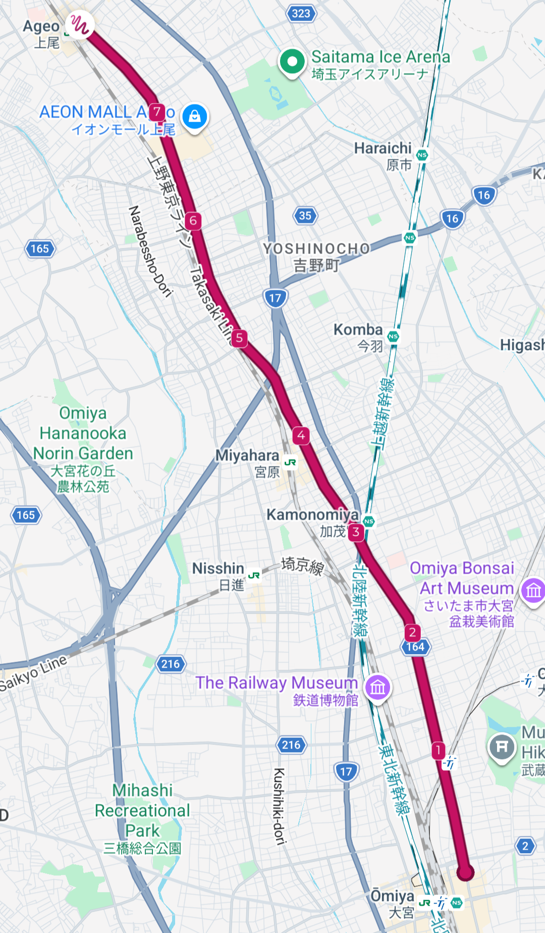
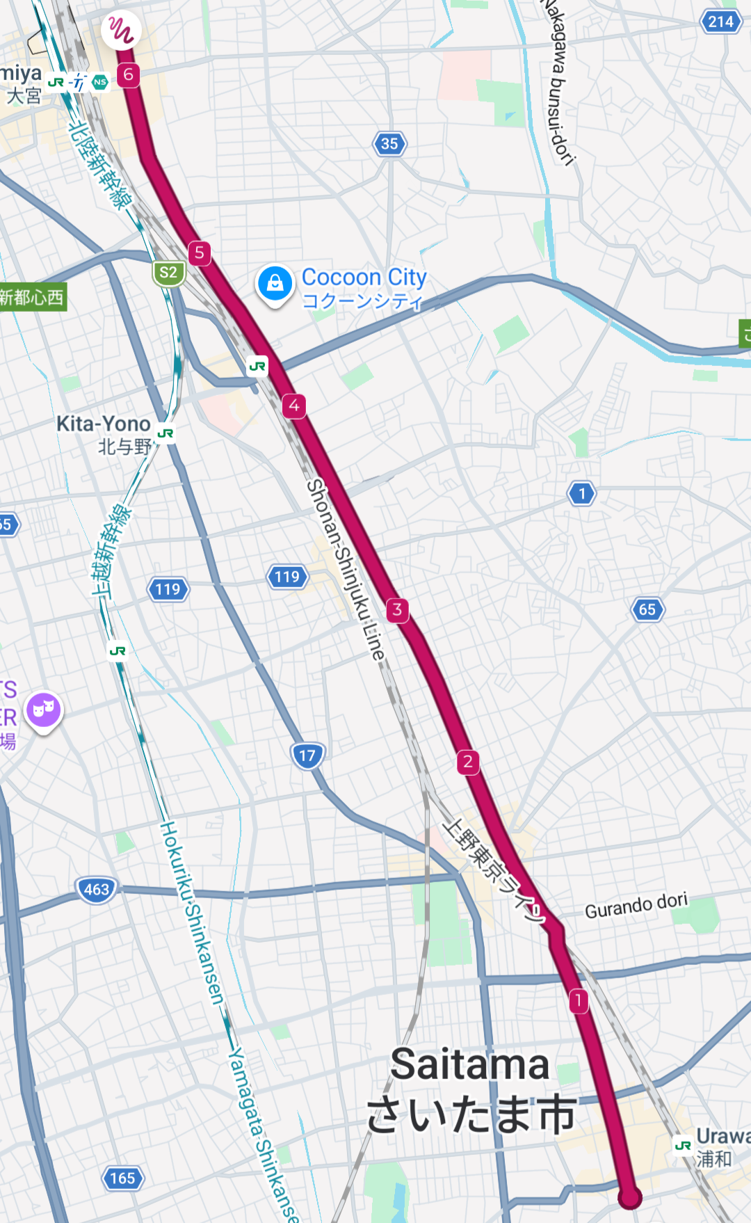
These three legs, the fourth, the fifth and the sixth, from Urawa all the way to Ogekawa are all pretty similar, and truth be told pretty tedious. You will be hiking along the National Route 164 all the way, with no deviations. While this road isn’t the worst, it’s pretty much trafficked the whole time, and the surroundings are a neverending mix of business buildings, shopping malls, and the occasional apartment complex. This doesn’t make for a very interesting hike!
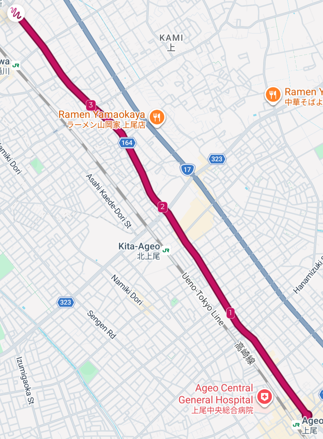
The legs, in reverse order, which makes the one furthest to the north at the top.
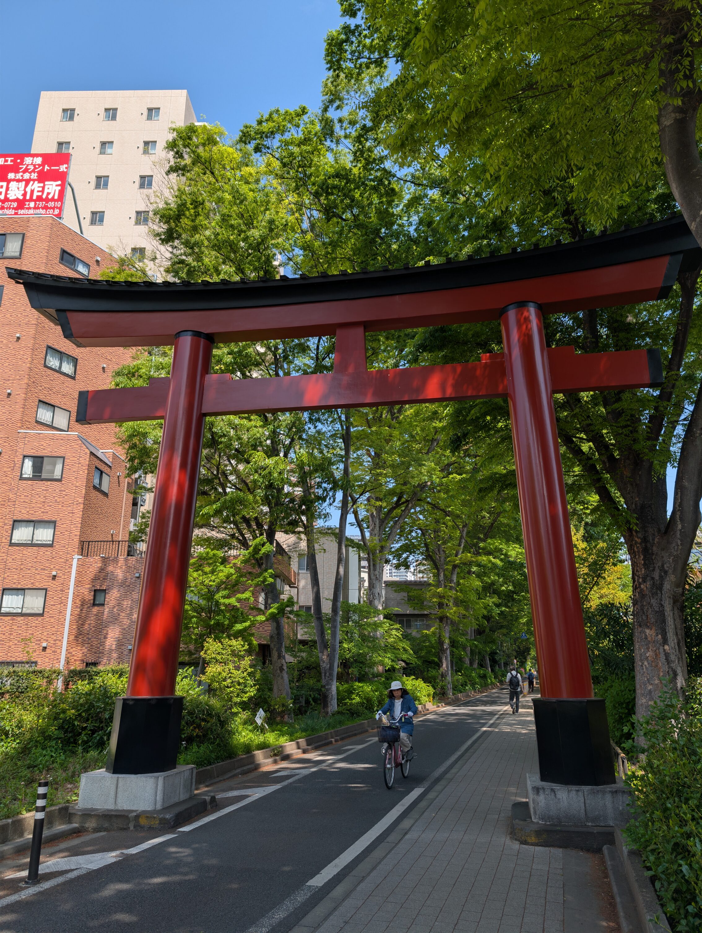
Luckily, there are some highlight! The Hikari shrine, for instance. While this ancient shrine (more than 1 500 years old) isn’t on the Nakasendō exactly, taking a small detour is absolutely worth it if you have the time and energy!
The Nakasendō itself looks mostly like this for almost 20 kilometres.
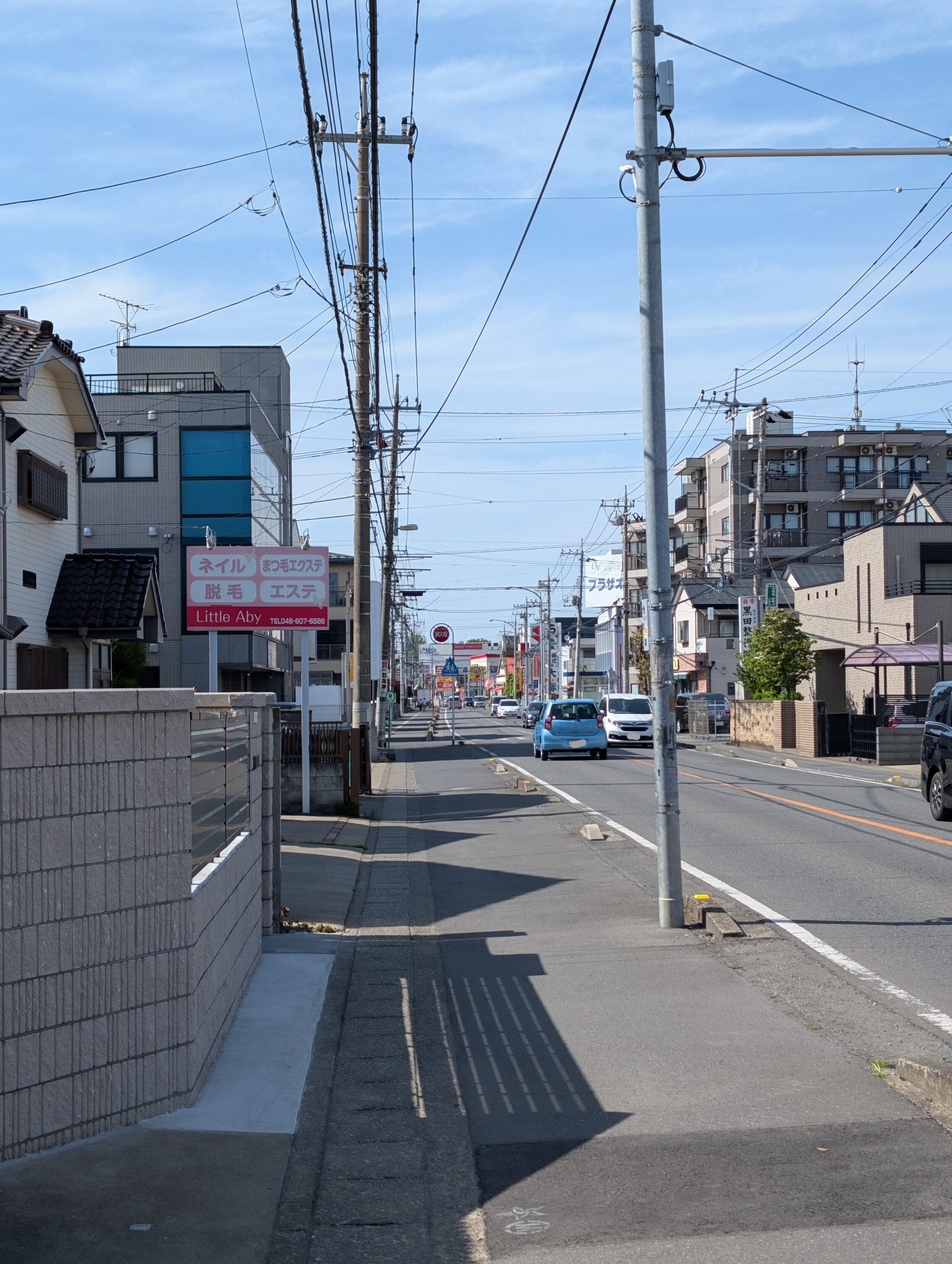
And no, that is not meant to be a product placement for Little Aby and her beauty salon. I hope she does ok anyway.
Along these three legs the Nakasendō had a number of milestones:
The Urawa ichirizuka (of which there is no trace at all, and no signs or anything)
The Ōmiya ichirizuka (same status)
The Kamomiya ichirizuka (guess what?)
The Ageo ichirizuka (this is getting boring)
The Okegawa ichirizuka has a small sign at least, beneath a yellow pedestrian bridge crossing the road.
When it comes to the post towns, they don’t fare much better until the very end.
Ōmiya-shuku doesn’t even have a marker or information board that it once was a post town. There is supposedly a sign inside a covered street market about where the old honjin was, ie guest house for government employees, but I couldn’t find it.
Ageo-shuku at least has a concrete pillar where the centre of town used to be with the text “Nakasendō Ageo-shuku”.
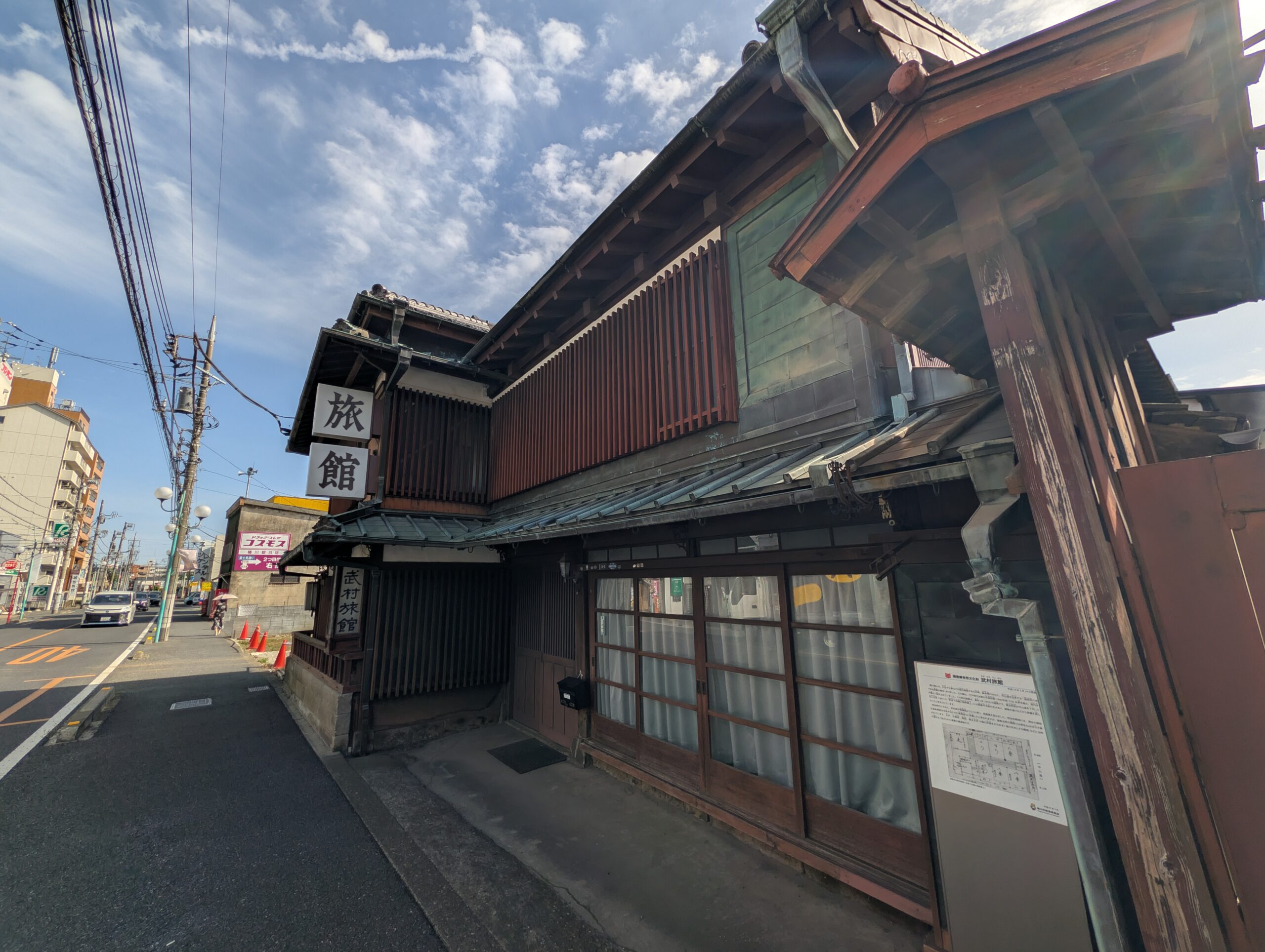
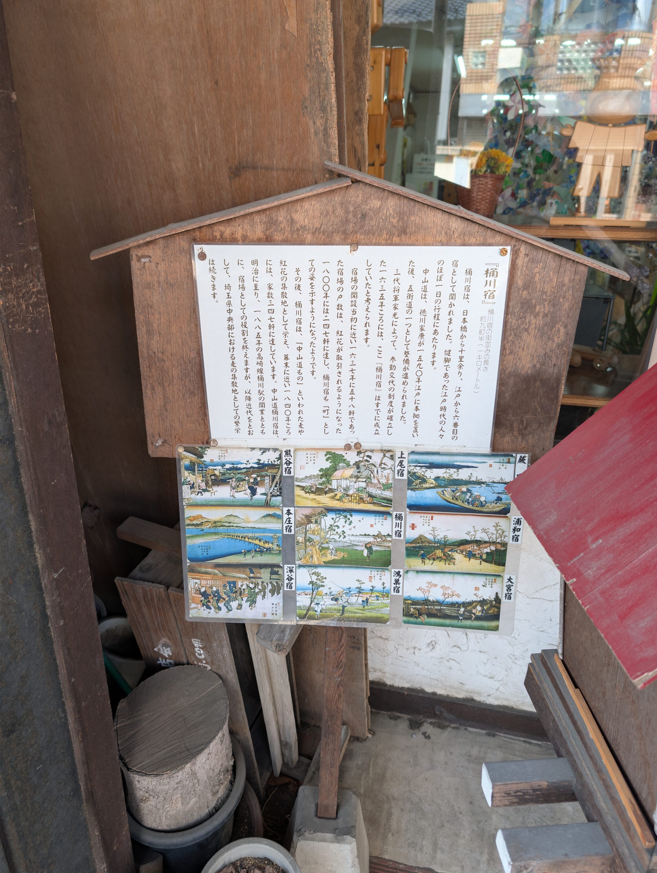
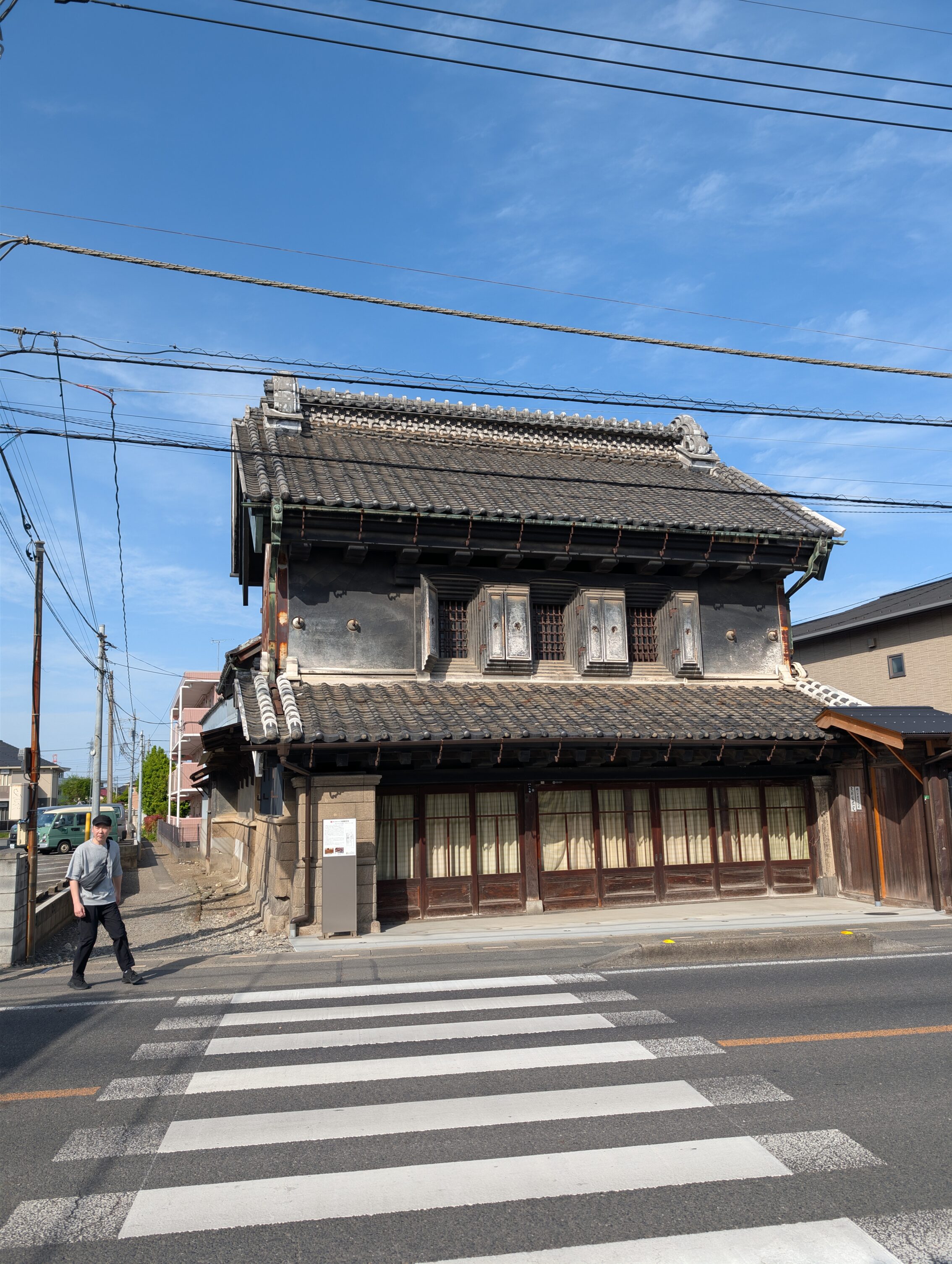
But Okegawa-shuku on the other hand has loads of stuff! Lots of buildings, a truly excellent tourist information with folders and maps about the still extant houses around town, as well as a try-it-yourself wood printing where you can make a small copy of the Hiroshige’s woodcut of the town from the early 19th century, and more. Also, don’t forget to check out the official eki-stamp for the post town, which also can be found in this great place! The town also boasts a lot of information signs by the buildings, so you know what you are looking at! The featured photo on this page at the top is also from Okegawa-shuku.
Total distance hiked today according to the map, including getting to the hotel: 26.8 km
Total distance hiked today according to my fitness app: 30.4 km. And yes, I am pretty sore this evening…
Tomorrow will be a bit shorter in total, about 20 km. First I’ll hike the remaining distance to Kōnosu-shuku (I walked about three kilometres along that leg today to reach my hotel), and then after that is one of the single longest legs on the whole Nakasendō, from Kōnosu-shuku to Kumagaya-shuku, which is more than 16 kilometres.


Leave a Reply