Along the way, The Nakasendō meanders across a varied landscape. It passes through deep forests, modern cityscapes, over steep mountain passes, and across countless rivers. All these various parts come with their own set of challenges. In order to summarise what kind of trail or road a hiker will be facing, the path can be divided into nine discreet areas or regions. While sometimes similar, these areas all have their own set of challenges and experiences. This division of the path as presented here isn’t necessarily completely historical, nor does it align with the modern day Japanese prefectures. Rather it is a way for a hiker to understand how the challenges of the Nakasendō change depending on which part of the route they currently are tackling. These regions are, in order from Tokyo:
- The Kantō plain
This area is characterised by a flat alluvial flood plain with almost never-ending cityscapes and suburbs - The Usui pass
The Usui pass is a rapid change of scenery from the plain. It presents a steep and pretty wild climb. - The Higashi-Shinshu Nakasendō
The volcanic plateau south of Mount Asama is steeped in history, but is still rather hostile to hikers because of how few hotels there are, except in the famous resort Karuizawa at the eastern end. - The Wada and the Shiojiri passes
The most difficult mountain pass of them all along the path, with the also quite challenging Shiojiri pass just next to it. Between them the path passes Lake Suwa. - The Kisoji
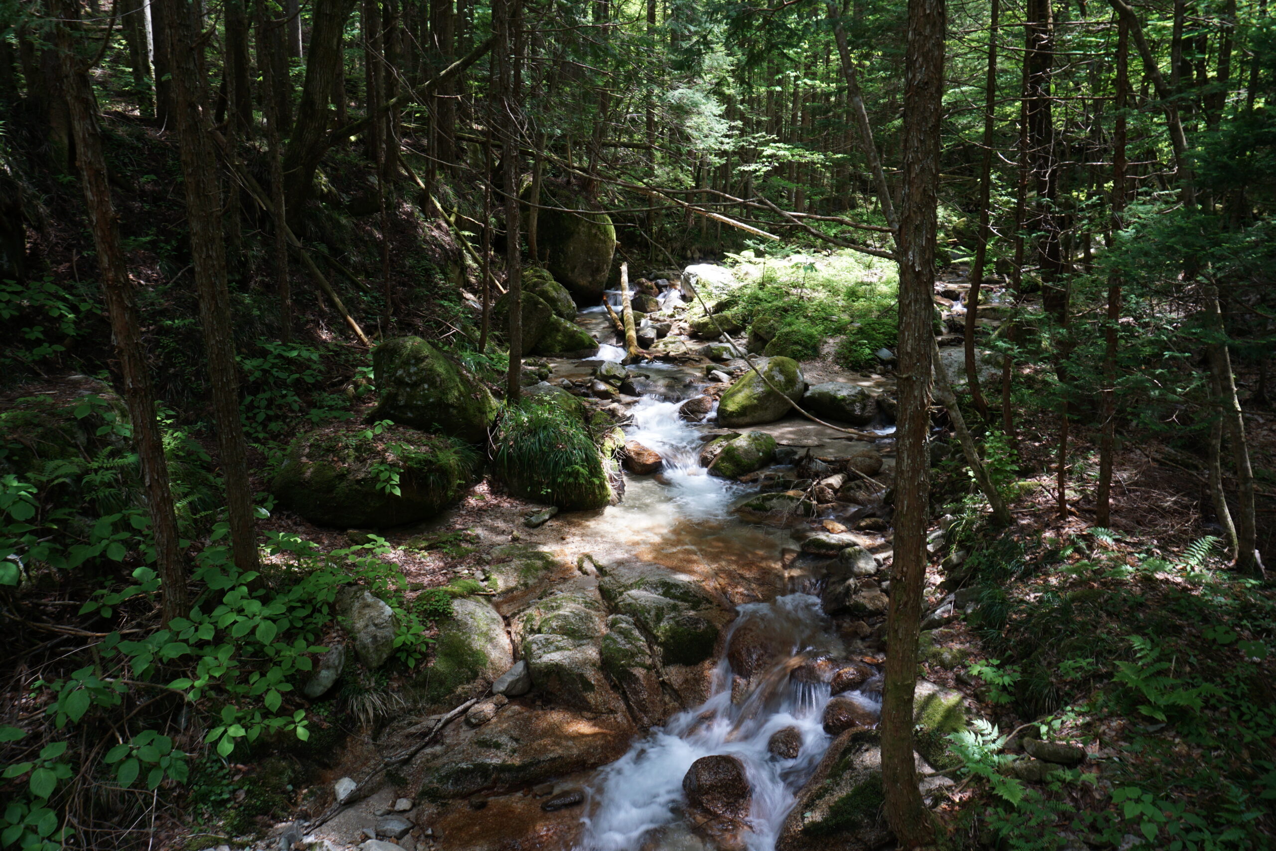
The jewel of the hike is comprised of deep mountain valleys, oodles of Edo period remnants and villages, and the almost ever present Kiso and Narai rivers. - South of the Kiso river
The path follows the river course, but is never near it. This area is mostly sparsely populated, and the Nakasendō crosses forests and often wild terrain. - Kiso Three Rivers
The northern parts of the Nōbi plain. The Nakasendō crosses countless rivers here, including the three mighty rivers the Kiso, the Nagara, and the Ibi. - The Ibuki Mountains
The path meanders through valleys with the Ibuki mountains to the north, and the Suzuka mountains to the south. It is an area famous for bad weather and lots of snow during the winter months. - Lake Biwa and the Tōkaidō.
The Nakasendō crosses the Ōmi plain to the east of the largest lake in Japan, Lake Biwa. It then rounds the southern tip of the lake and finally heads into Kyoto. The last part of the Nakasendō is the same as the other Edo period road between Tokyo and Kyoto, the Tōkaidō.
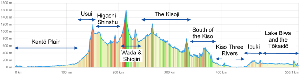
Again, there is no real historical science to all of these divisions except in a few cases such as the Kisoji, i.e. the Kiso Valley, the Kiso Three Rivers, and the Higashi-Shinshu which were all named areas during the Edo period, and even earlier. It is rather a way to help understand how hiking will differ in nature and what kind of experiences a hiker will have to tackle along the way.
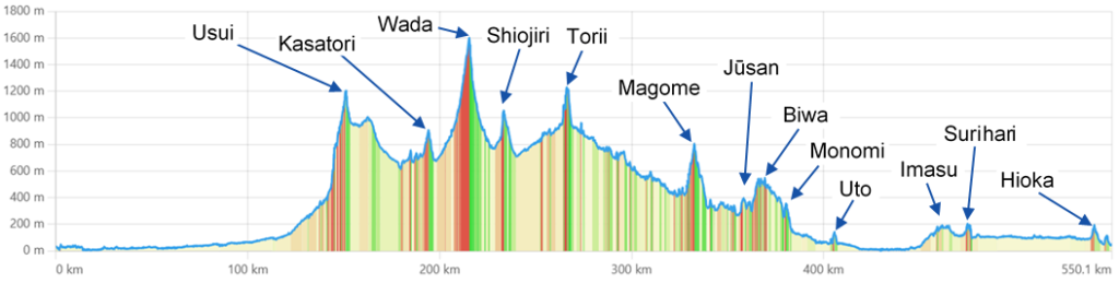
Here is the same graph, but with the information about the names of the various mountain passes that you will traverse on your hiking! The mountain pass between Magome and Biwa might not seem that pronounced, but is a section that was called the “thirteen mountain passes”, the Jūsan-tōge. In this area, the Nakasendō follows an undulating ridge in the forests east of the treacherous Biwa pass, with many, many steep slopes going up and down. The highest mountain pass that the Nakasendō crosses is of course the Wada pass. It is still a challenge today as there are very few, if any, places of succor along the 22 kilometers between Wada-shuku and Shimosuwa-shuku, i.e. almost no restaurants, hotels, or even buses, while at the same time challenging a hiker with some pretty steep hiking in both directions.
The elevation differences in the graphs are obviously not to scale with the distance travelled!


Leave a Reply