This day was a sometimes fantastic hike, and at other times rather hard on the psyche. I started off in Kiso-Fukushima, hiked via Agematsu-juku and ended up in Suhara-juku at the end of the day. On the positive side of things, there were some truly spectacular sights along the way such as the Kakehashi bridge, the Nezame no toko gorge, and a stunning view of Mt. Ontake. The negative was that the second leg, between Agematsu-juku and Suhara-juku meant a lot of hiking was spent right on the National Route 19, the highway that spans the length of the Kiso valley.
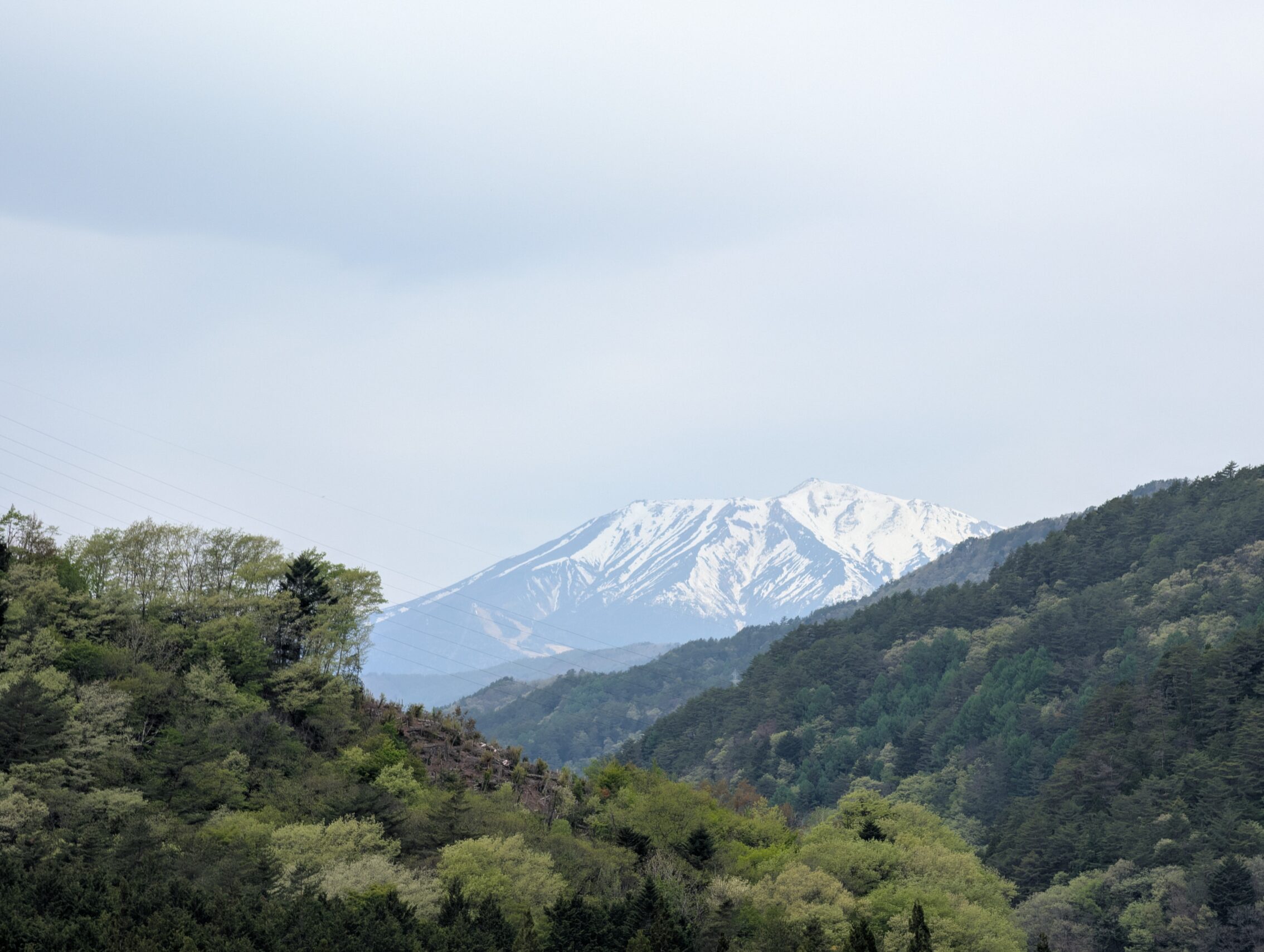
Mt. Otake is a revered mountain with lots of temples surrounding it, and was the inspiration for warlord Kiso Yoshimoto during the Warring States period of Japan. (See the post about crossing the Torii Pass). The Nakasendō presents yet another excellent view of this mountain, albeit form a bit afar.
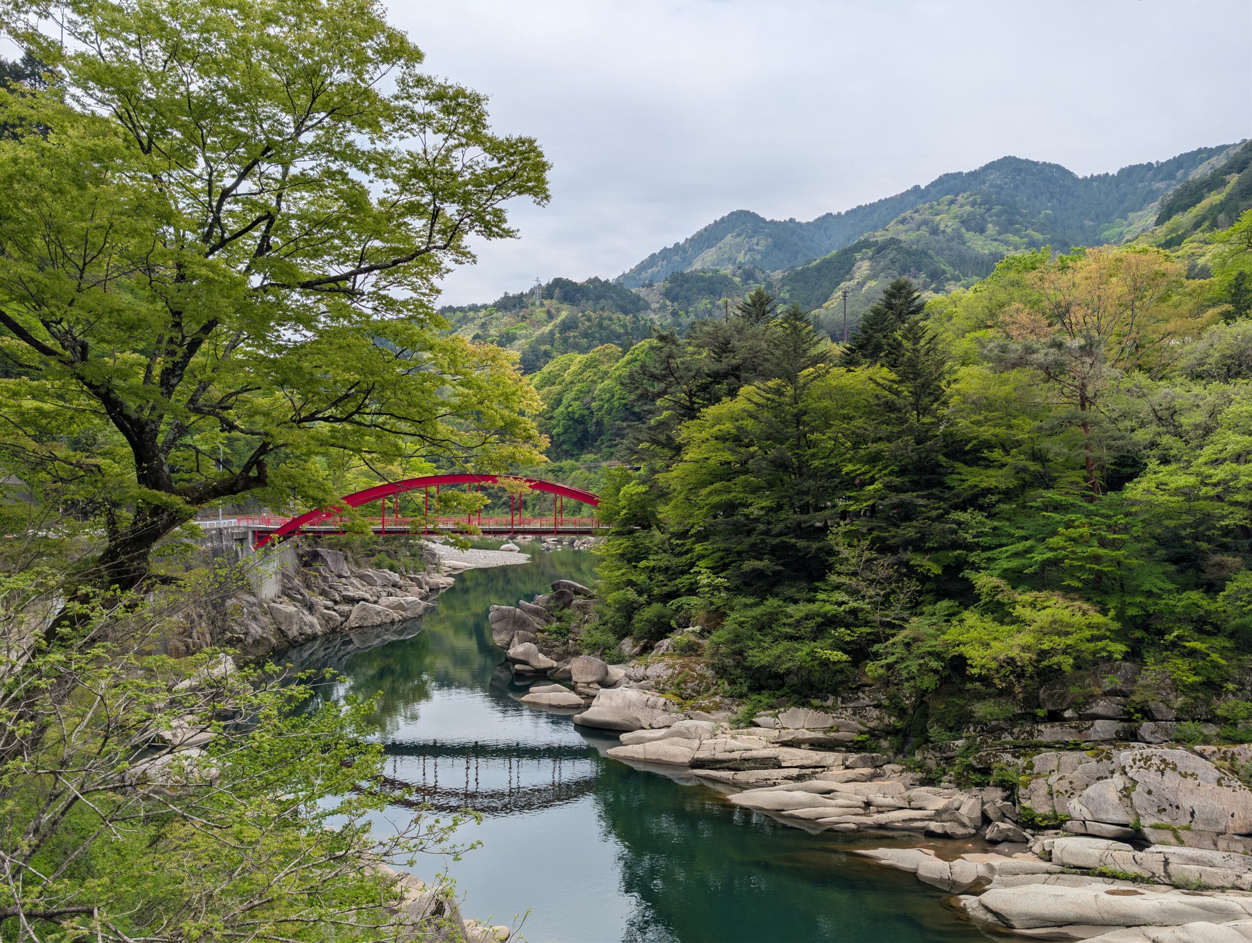
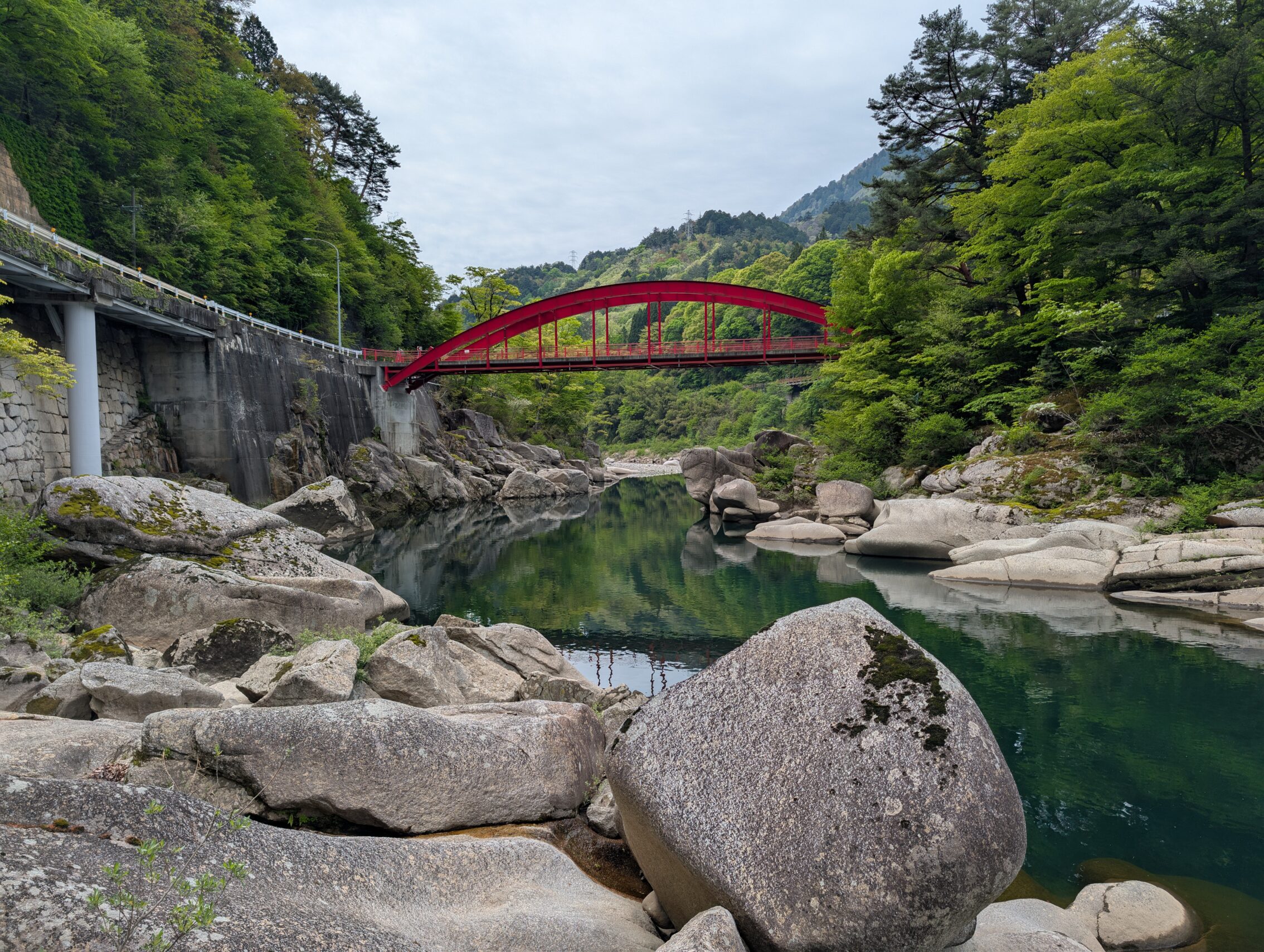
The Kakehashi bridge in the middle between Fukushima and Agematsu is a bright red bridge that crosses the Kiso, and the Nakasendō passes just by it. It presents one of the more famous beauty spots along the path.
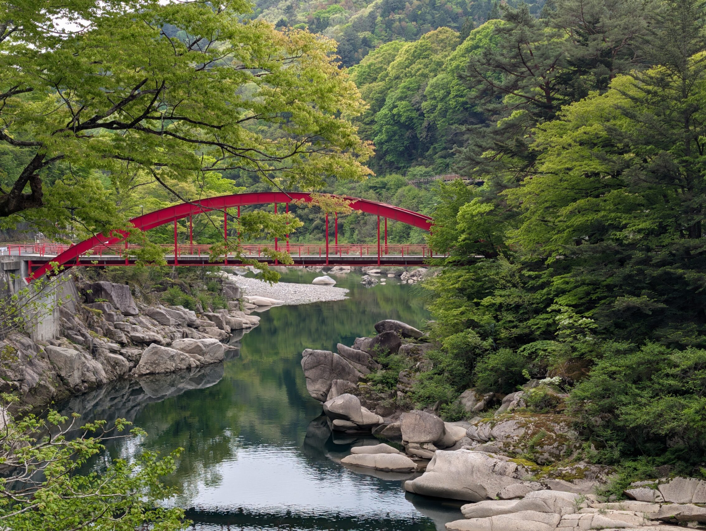
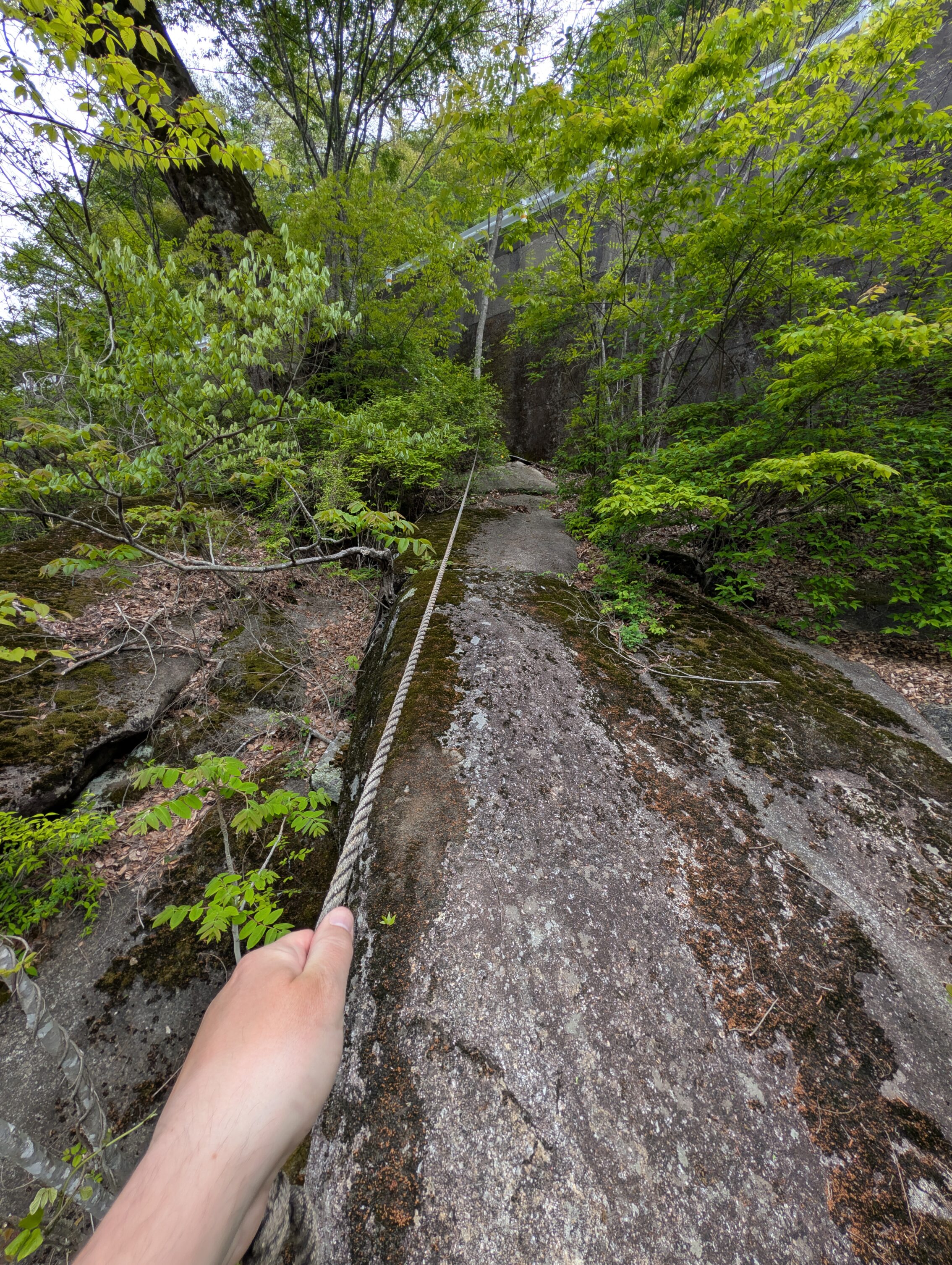
Also just by the bridge there was a tiny gap in the safety railing towards the river, and a *steep* and narrow set of concrete stairs leading down. Could I resist that? Of course not. And when at the bottom of the stairs, the river bed was still dangerously steep, but luckily the authorities had provided a rope to help climb even further down. Could I resist that? Of course not. Was I still carrying my backpack? Of course. Did I regret that when I reached the bottom. Well… the views from the riverside were stunning, but… yes. Getting back up was a bit of a hassle. But luckily, I’m not hiking alone, and there was someone else who could help me if something happened, right? Uhhh… No.
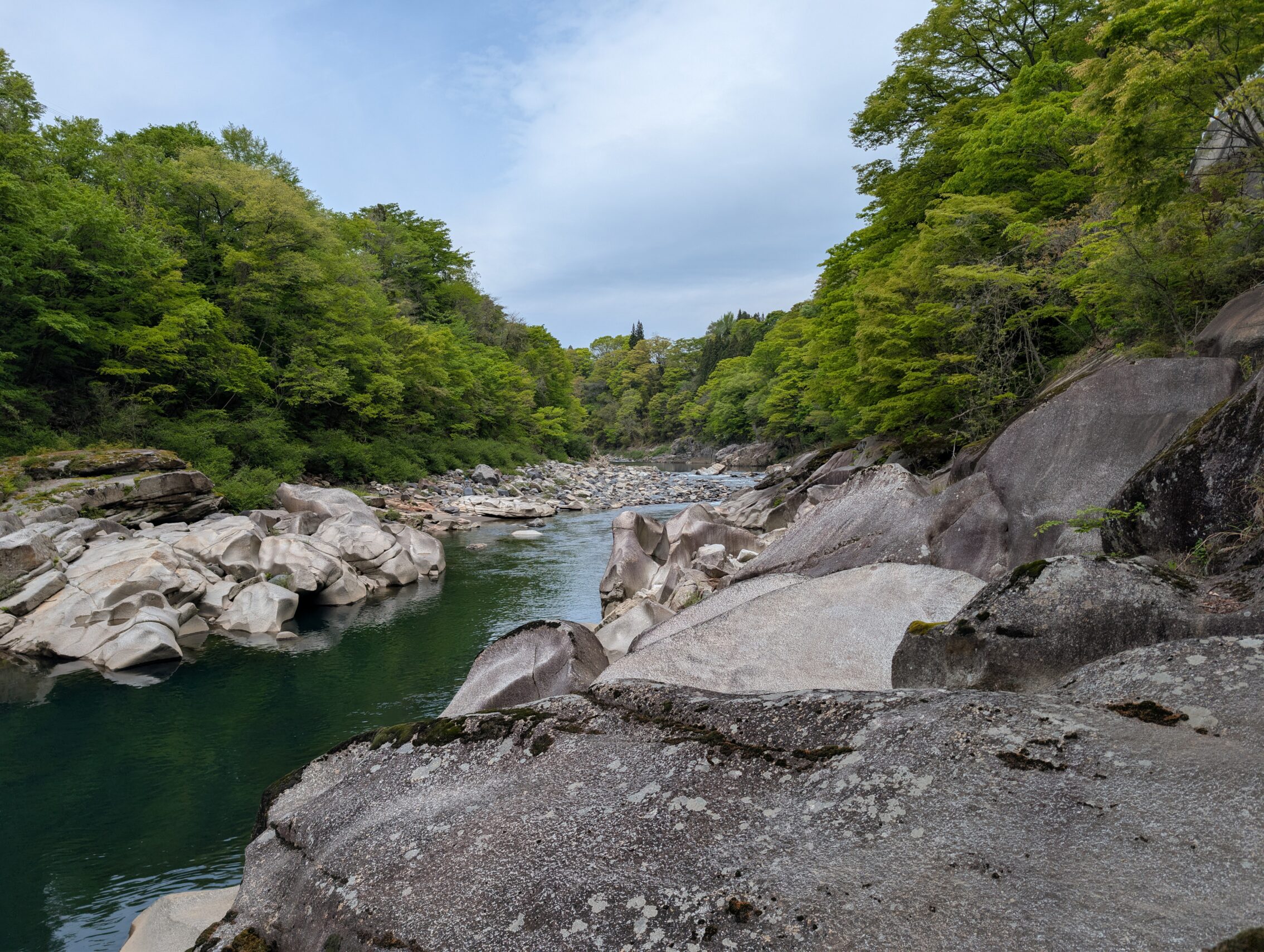
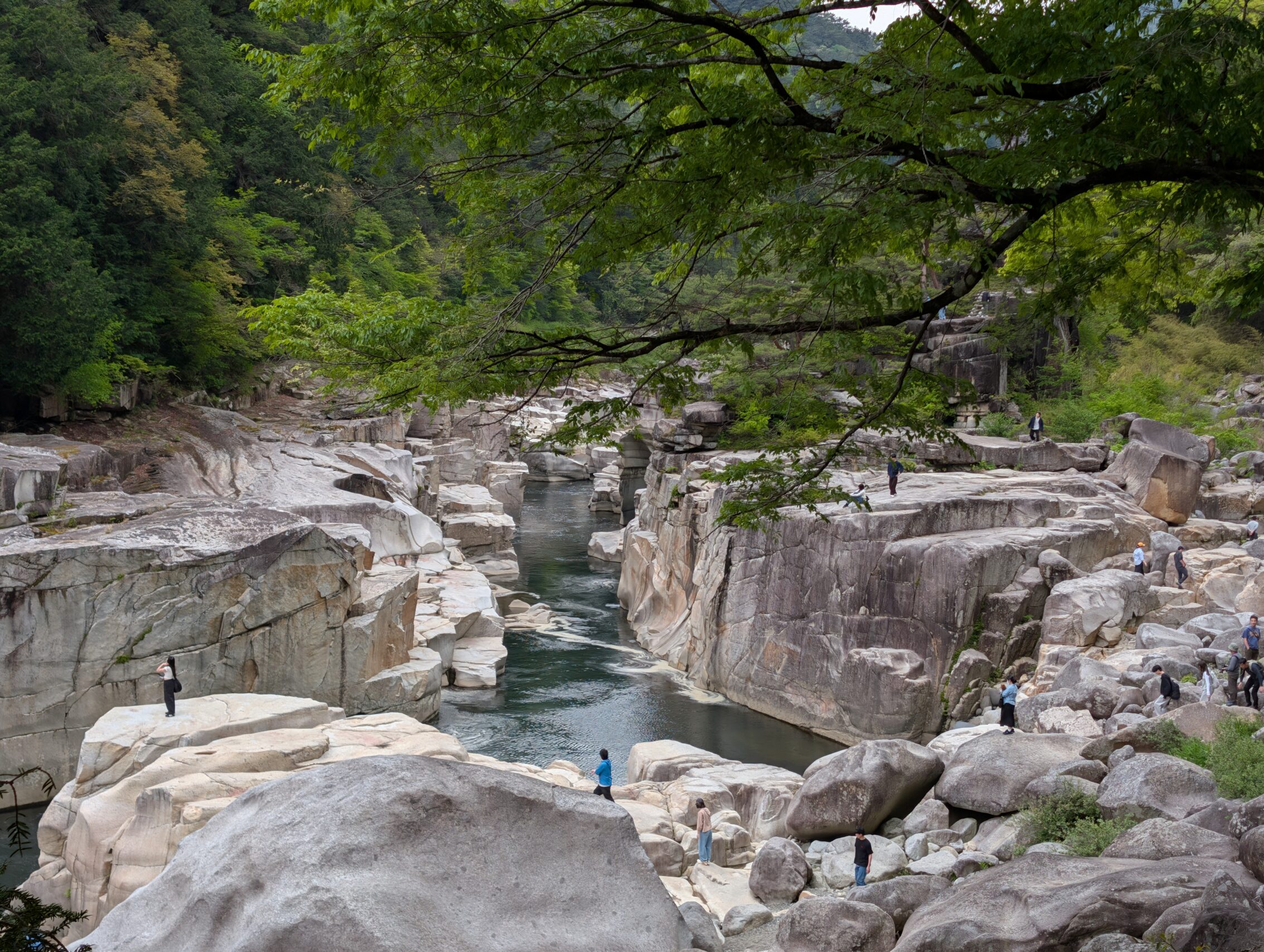
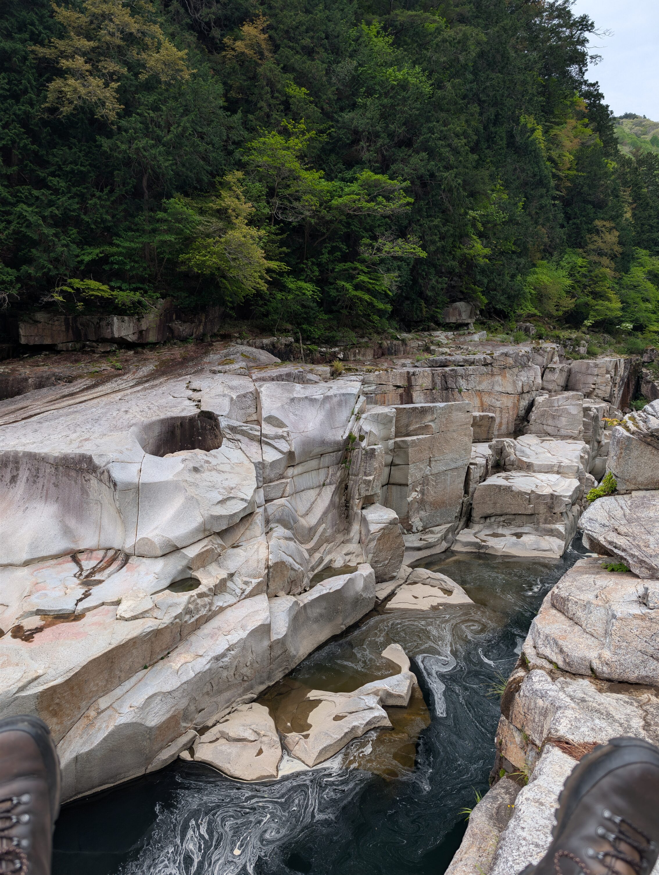
The Nezame no toko is a gorge a couple of kilometres south of Agematsu-juku where the Kiso river squeezes through a very photogenic section of mostly granite rock formations. This place isn’t on the Nakasendō exactly, but is absolutely worth a small detour, and after having conquered the Wada and Usui passes and more, hiking down about 100 vertical metres to the river bed over 400 metres, and then back up again feels like a breeze! 🙂
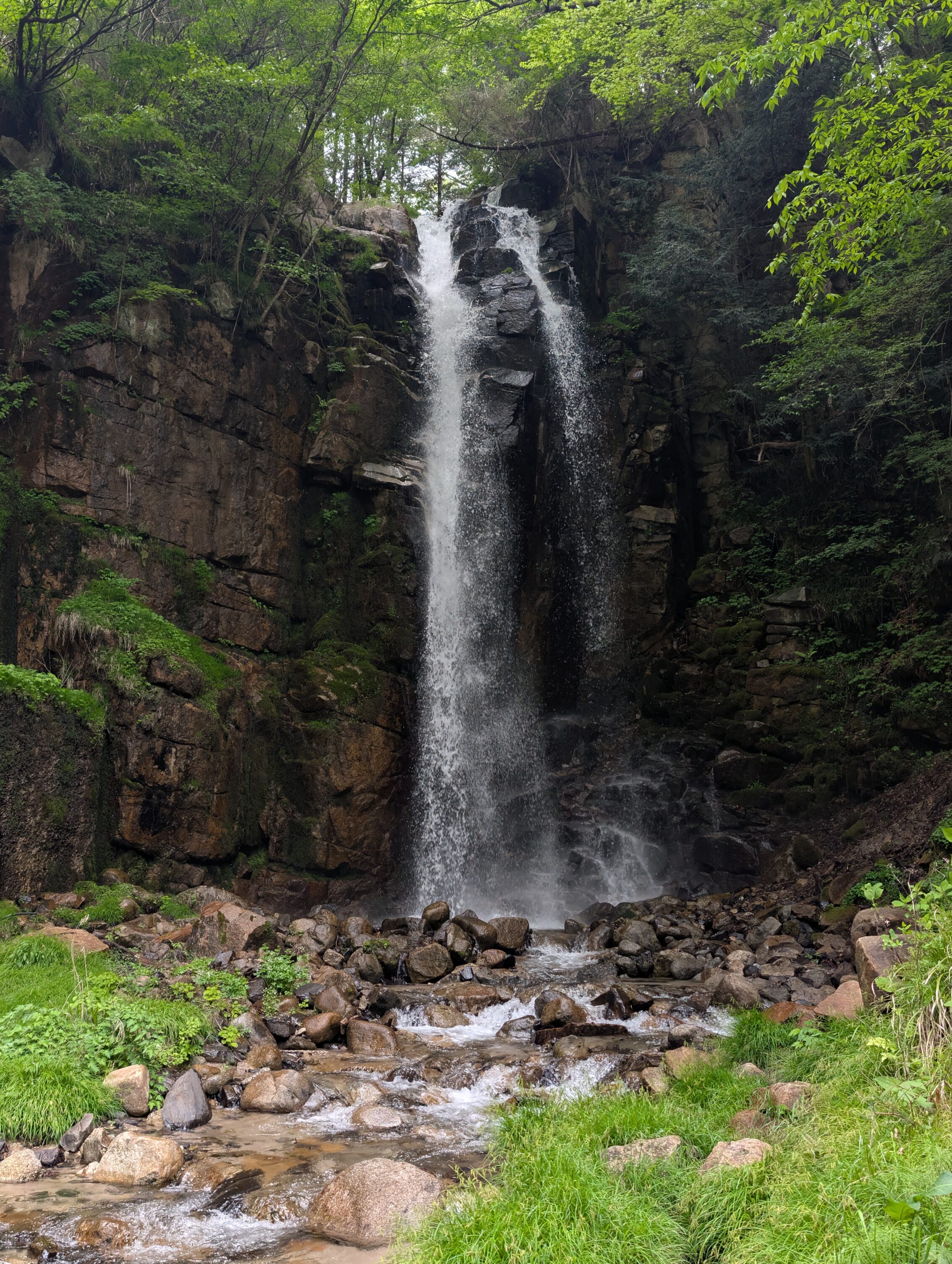
Even further south towards Suhara-juku is another famous spot along the Nakasendō in the Kiso valley. The Ononotaki waterfall is just by the path, even if said path is right on the National Route 19 here.
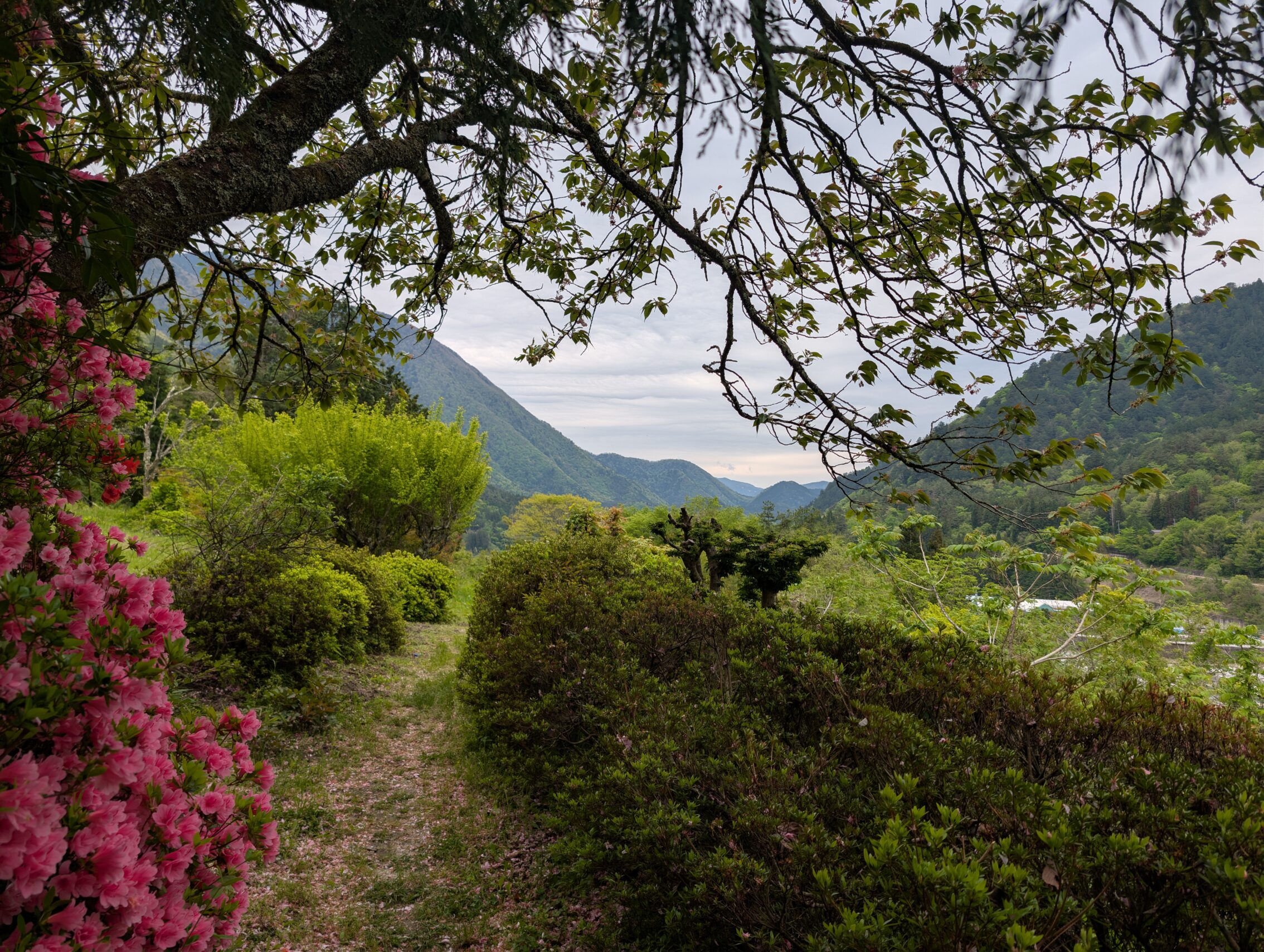
Further on there is a passage before reaching Suhara-juku where the path deviates from the highway, and immediately I got rewarded by this view!
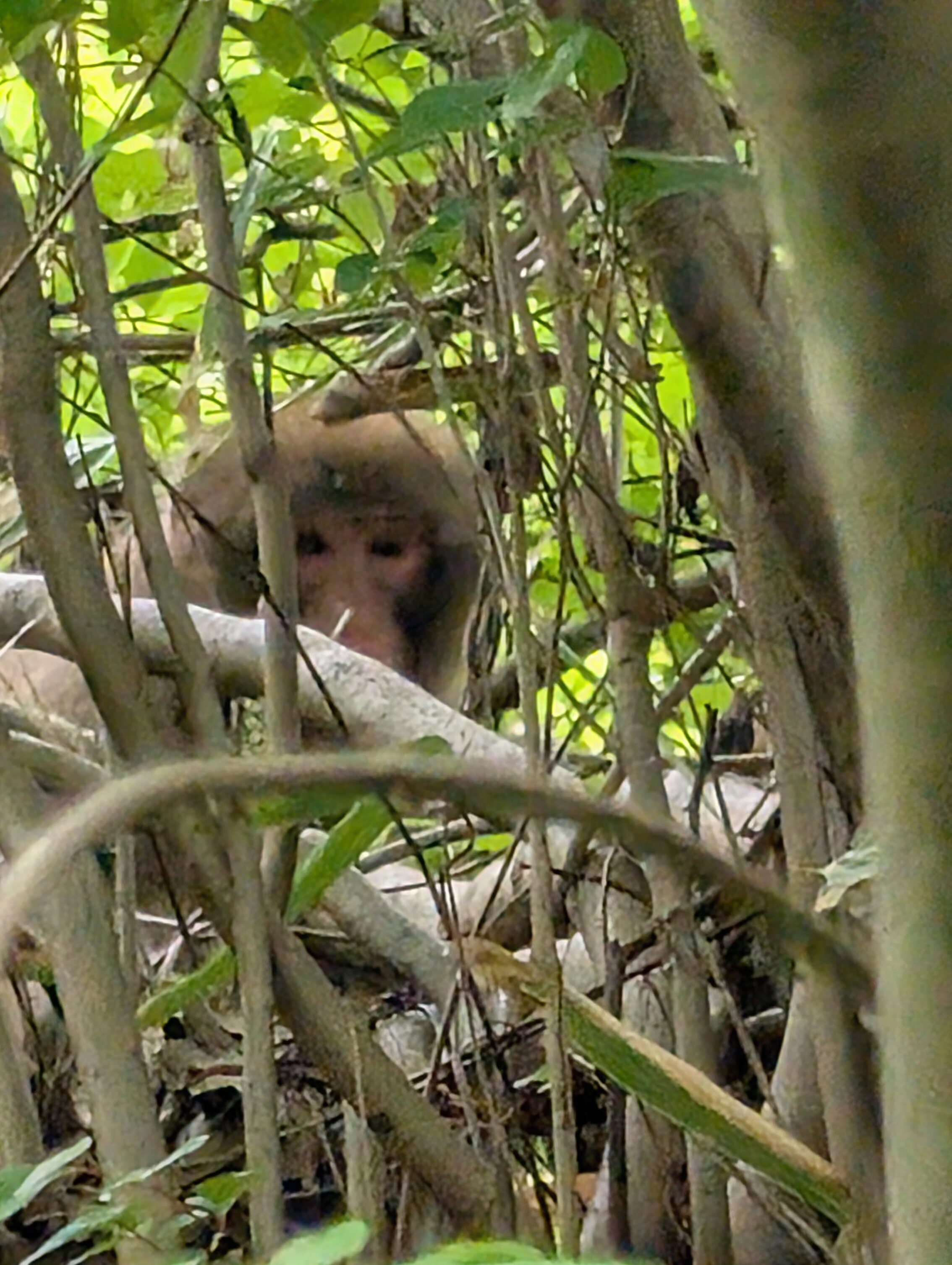
But this day wasn’t finished there! Even after all those cool experiences, I got an excellent surprise just as I was heading into Suhara-juku. Monkeys! There was a bunch of them (scientific term) in the trees surrounding the path, and while they scampered off quickly when I approached. Bear-belled as I was, I didn’t exactly startle them which is always a good thing. A startled bevy of monkeys (also a scientific term) can be rather vicious. One of them was a bit interested in watching me, so I snapped a few pictures before leaving them alone. The quality of this photo is rather bad, but it is 30x zoomed in.
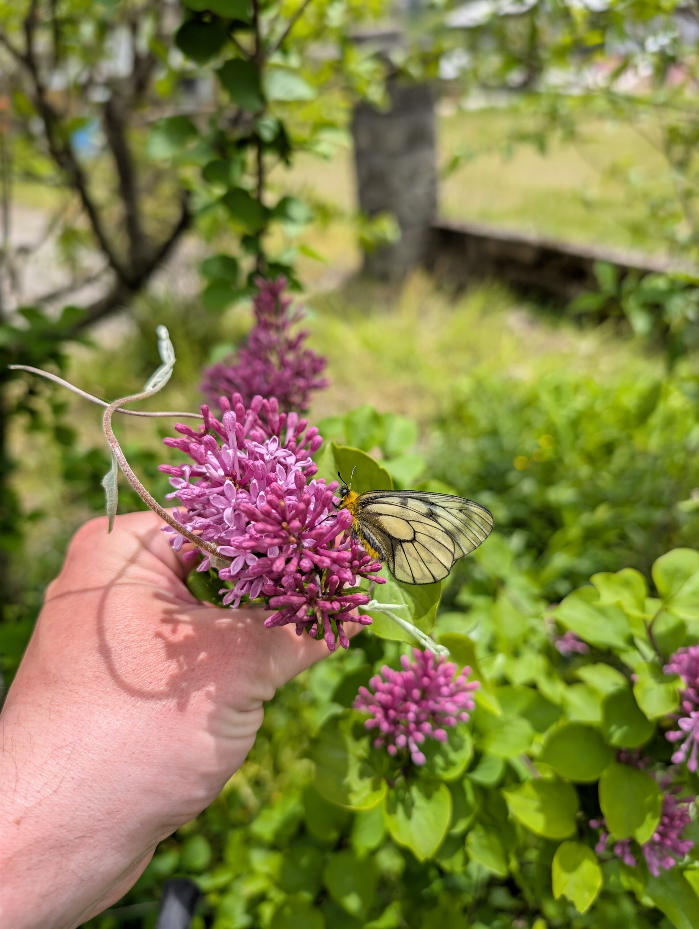
I also got a chance to see a Parnassius Glacialus as well. It’s a beautiful species of butterfly that only inhabits high-altitude areas in Japan, Korea and Eastern China.
Suhara-juku is so far one of my favourite post towns. It may not have as many older buildings as say Narai, and some of them look pretty abandoned, but the local people take great pride in their hamlet. There were flowers everywhere, and they have these so called mizubunu, “water boats” that collect water from the mountains. These troughs were originally made from Japanese cedar tree trunks, and there are still a number of those left.
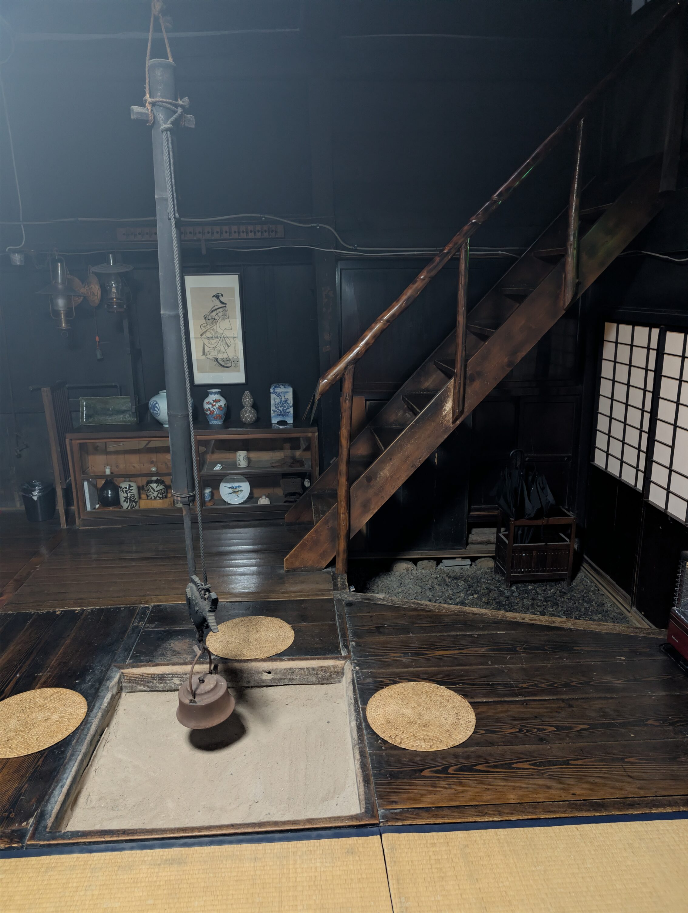
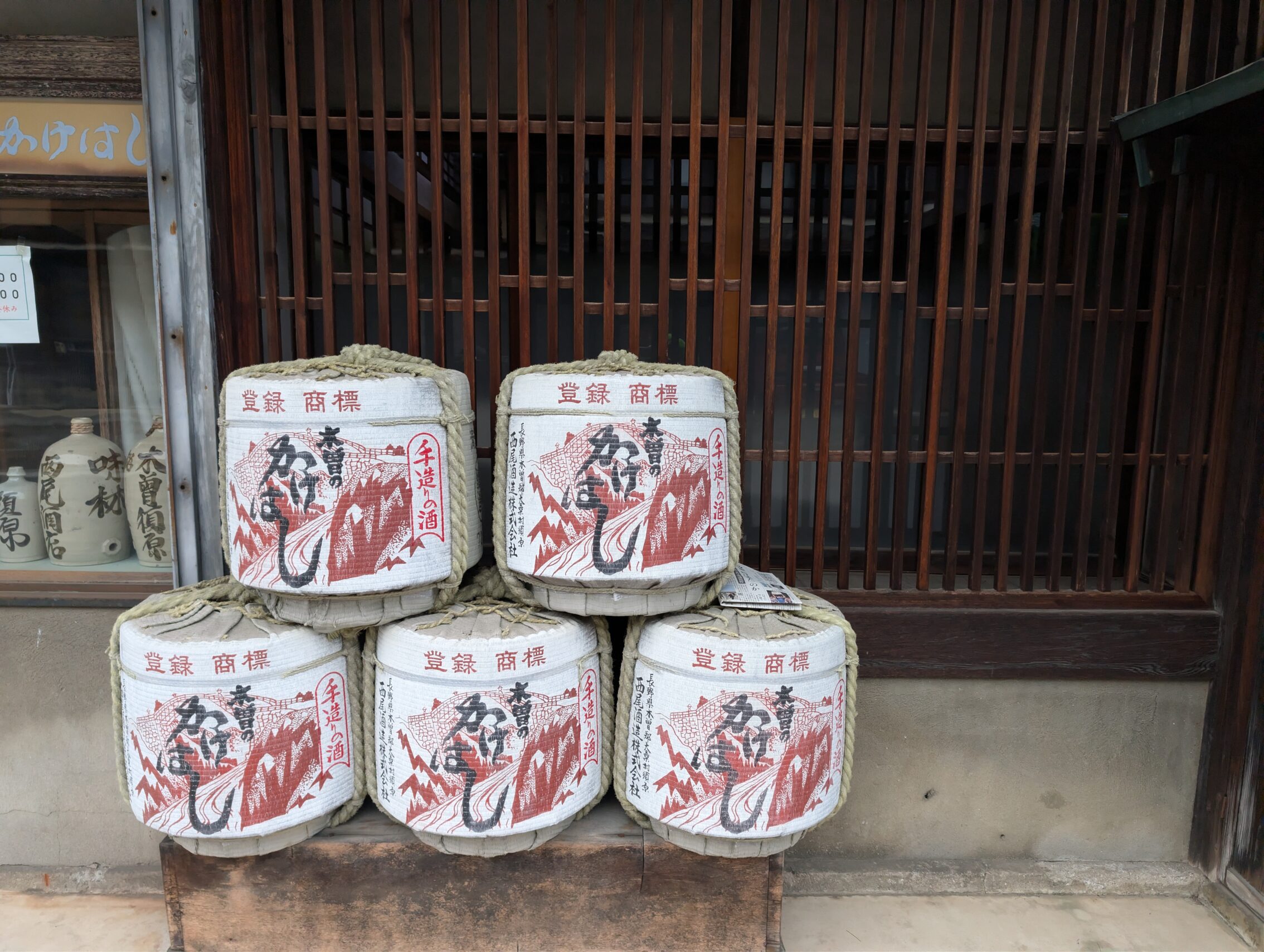
Also, they had a lovely sake brewery that I managed to visit just before they closed. I asked the lady in their shop if they had any good sake in a smaller bottle. She was very frank with that “no, we don’t bottle our best sake in smaller bottles, but we have a few varieties for tourists and restaurants”. After a lot of hiking, it was still an awesome drink to have in the house seen above!
All in all, this day presented some of the cooler things I’ve seen so far.
Milestones encountered. All of them have stones marking the spots, but there are no mounds at all.
The Shiobuchi ichirizuka
The Kutsukake ichirizuka
The Honmachu ichirizuka
The Hagiwara ichirizuka
The Kuramoto ichirizuka
The Suhara ichirizuka
Kilometres hiked according to the map (excluding detour to the gorge): 19.5 km
According to the app: 24.2 km


Leave a Reply