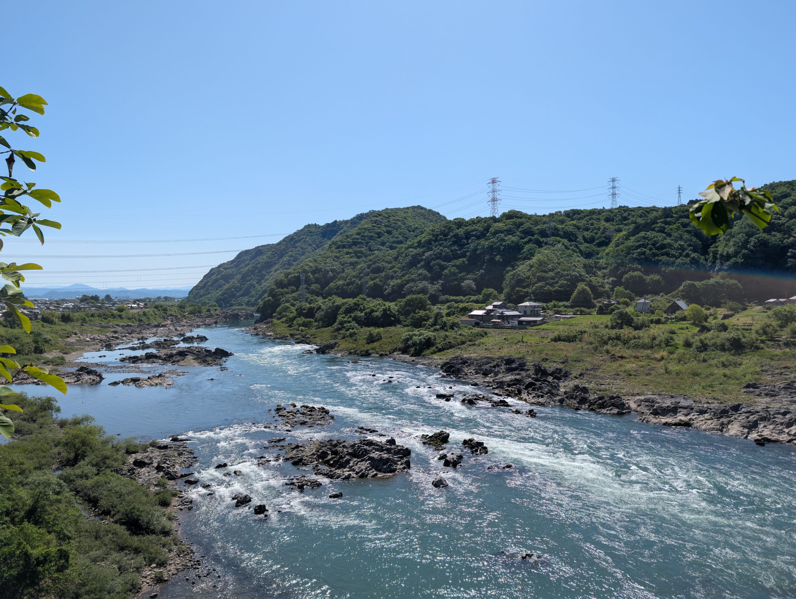
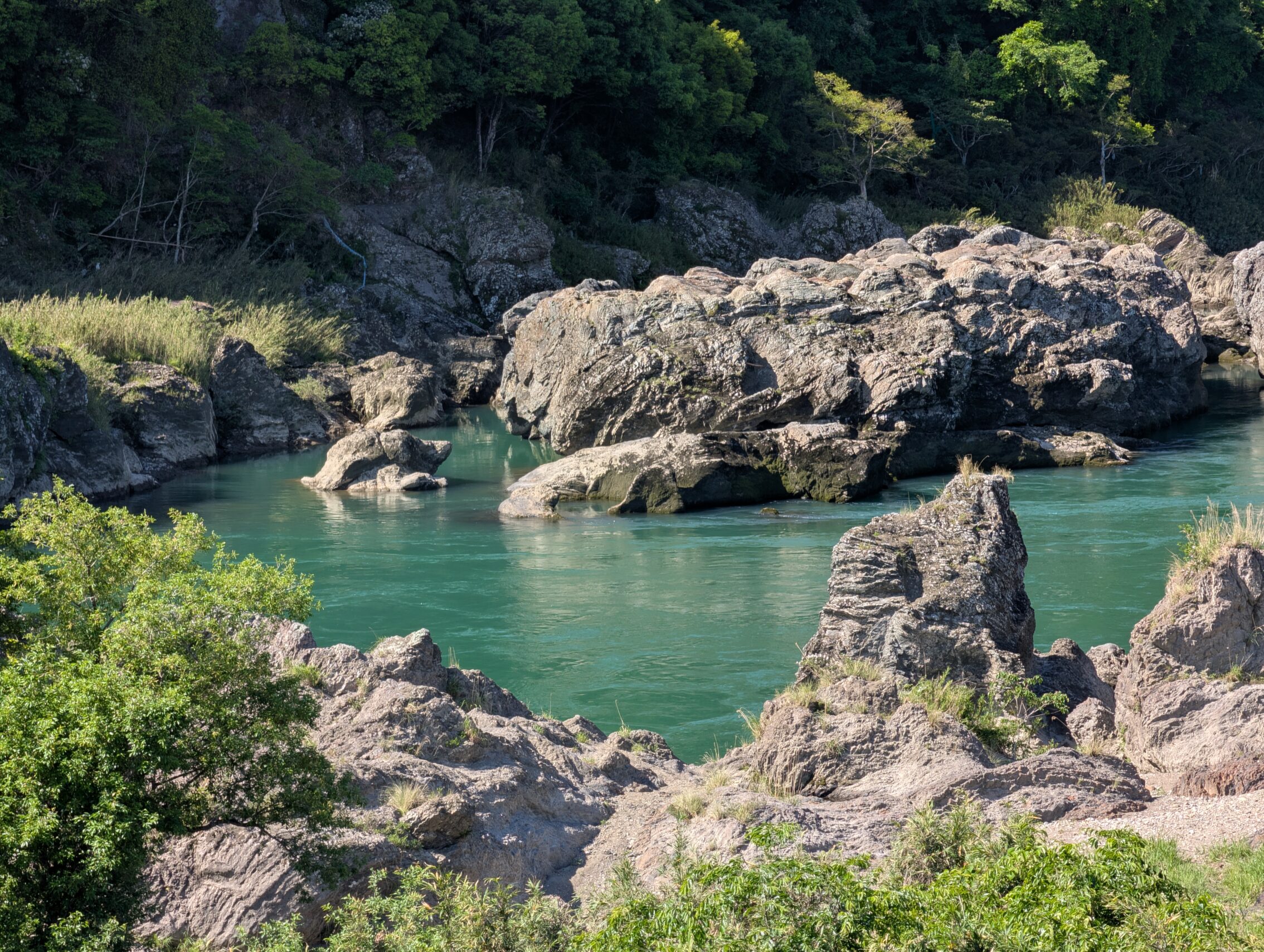
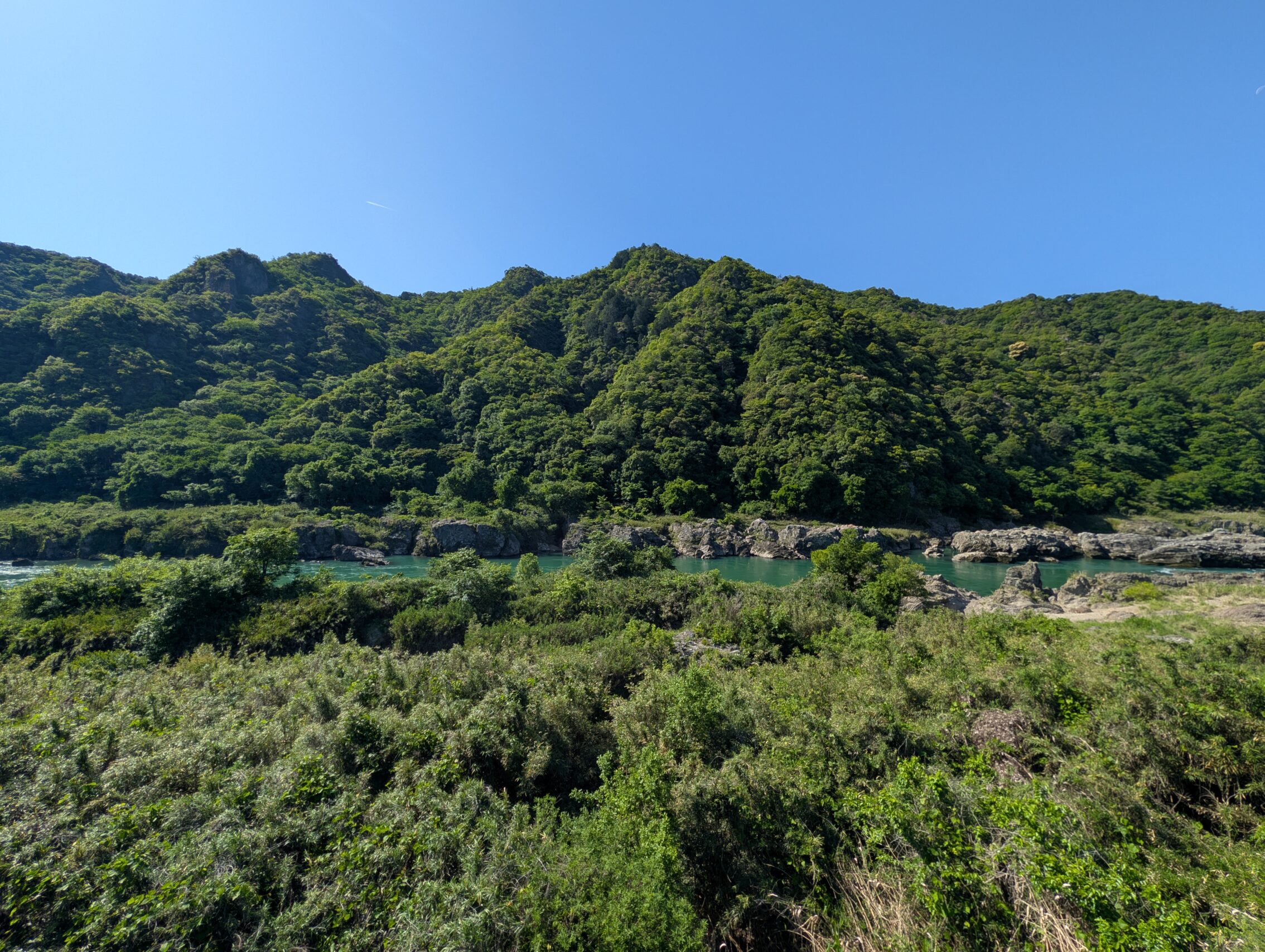
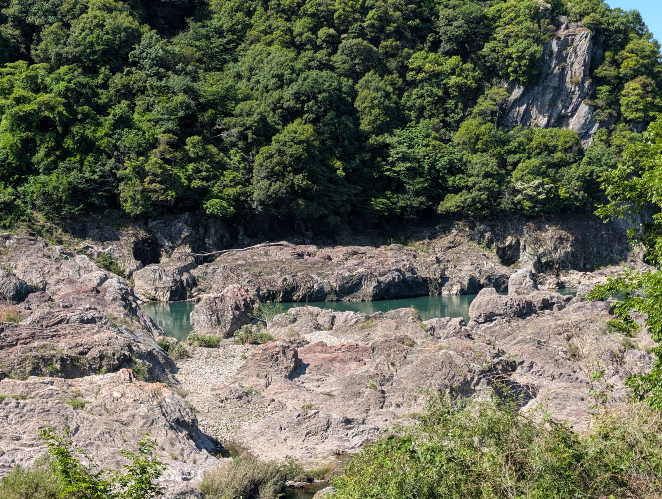
This was a very varied hike. It started on the southern banks of the Kiso river, crossed that waterway (for the last time), and then followed it on the northern side instead. This part of the river valley is called the Japan Rhine, because of its similarity to the Rhine region in Germany, and because Europeans can’t relate to anything unless it is compared to something European (see the Japanese Alps as well). The river is surrounded at this stage by often sheer rock walls, and there are even a few castles high up among the crags. In the middle of this area is Ōta-juku, which today is protected by a giant embankment. The Kiso has been known throughout history to sweep through the area, flooding everything, but even with these modern safety measures, the locals still treat the river with respect. During the Edo period the place for crossing the river had to change because a flood destroyed everything. This meant that the Nakasendō itself had to be diverted, and an old post town, Tsuchida-juku was abandoned, and a new one, Fushimi-juku, was opened. It also changed one of the milestones in the area.
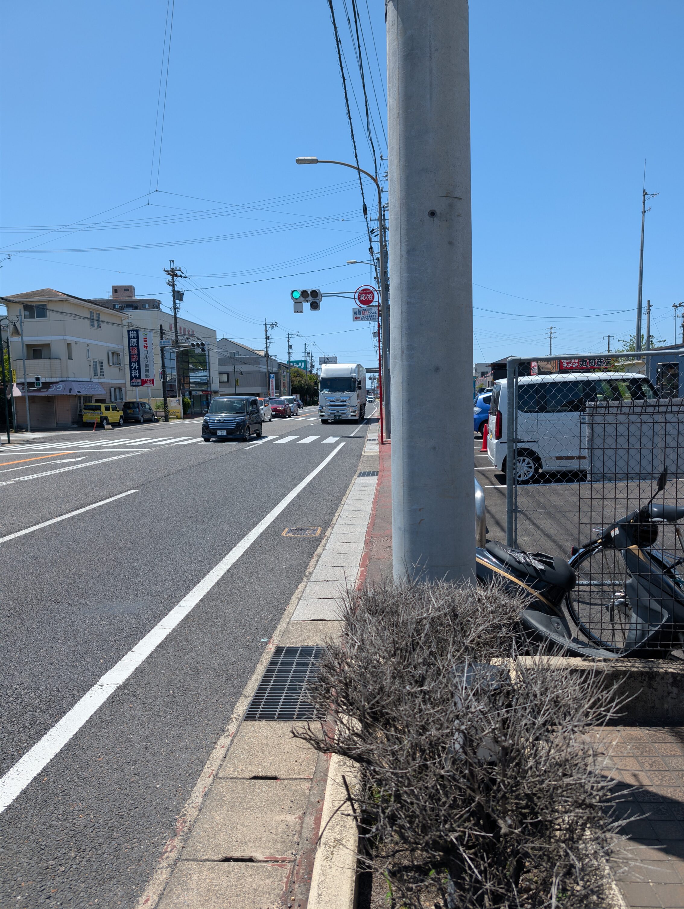
The Nakasendō then climbs out of the river valley across the Uto pass, and heads straight east towards Unuma-juku. I didn’t stop for the day in that post town, but walked an additional seven kilometers towards the next shukuba, Kanō-juku to get to the hotel for the night. That particular leg is almost 17 kilometres, so there’s a lot left for tomorrow before I reach Kanō-juku. This stretch of the Nakasendō is known for being a chore though. You spend a lot of the time right on the large National Route 21, including on some depressing flyovers when the road crosses a couple of railway lines.
Crossing the Kiso river between Fushimi-juku and Ōta-juku was one of the three most dangerous things to do on the Nakasendō. However, there are at least ten or so places who make this particular claim, but I can understand why this particular river crossing is treacherous. It doesn’t take a lot of flooding for the river to become completely different, and any knowledge of where dangerous eddies and shallows are becomes totally useless.
Ōta-juku is a charming place, with a lot of buildings, a small exhibition about the Edo period, and they generally seem to care a lot about their past. The people who lived here used to depend on fishing for their livelihoods, and they often used cormorant birds to help them do this from their narrow flat-bottomed boats. This way of catching fish is still practiced, and there are records of this tradition going back over 1 300 years.
The leading away from Ōta-juku the path follows the Kiso pretty slavishly for several kilometres. There were some absolutely stunning views on this part of the hike!
If you want to become scared of rivers, read up on the Strid, which is the name of a short stretch of the river Wharfe in Yorkshire, England. Anyway, back to Japan.
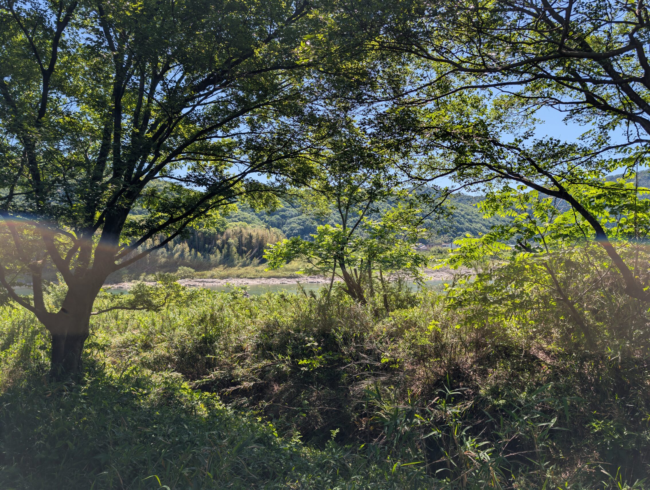
The Uto pass is somewhat steep on the side towards the river. It isn’t really a mountain pass, though, but more of a hill you can traverse in about an hour. Before the Nakasendō can head up the hill, it needs to pass the highway and the railway line, and it does this via a tunnel. This is the view just before you head into said tunnel:
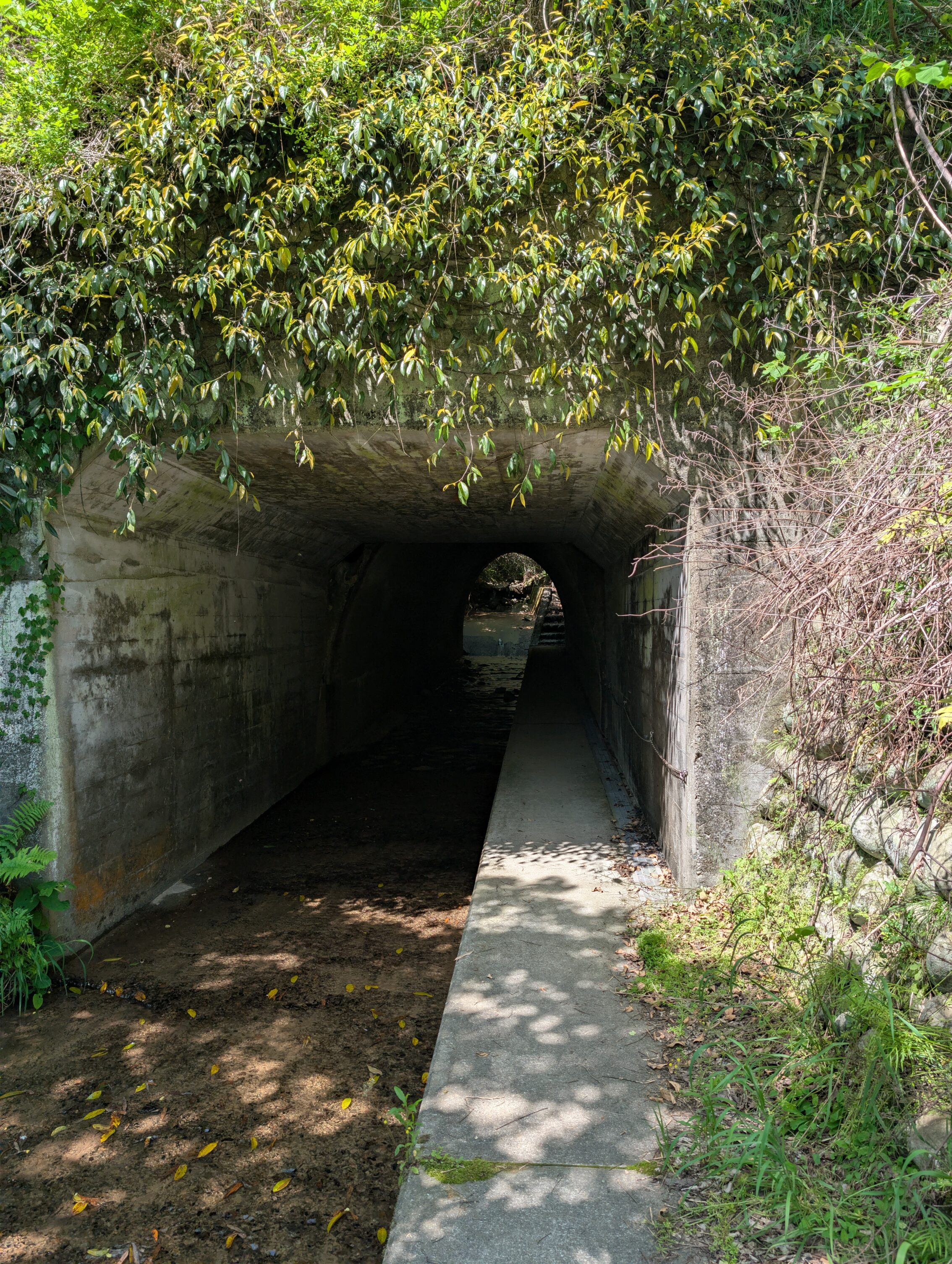
And here is the tunnel.
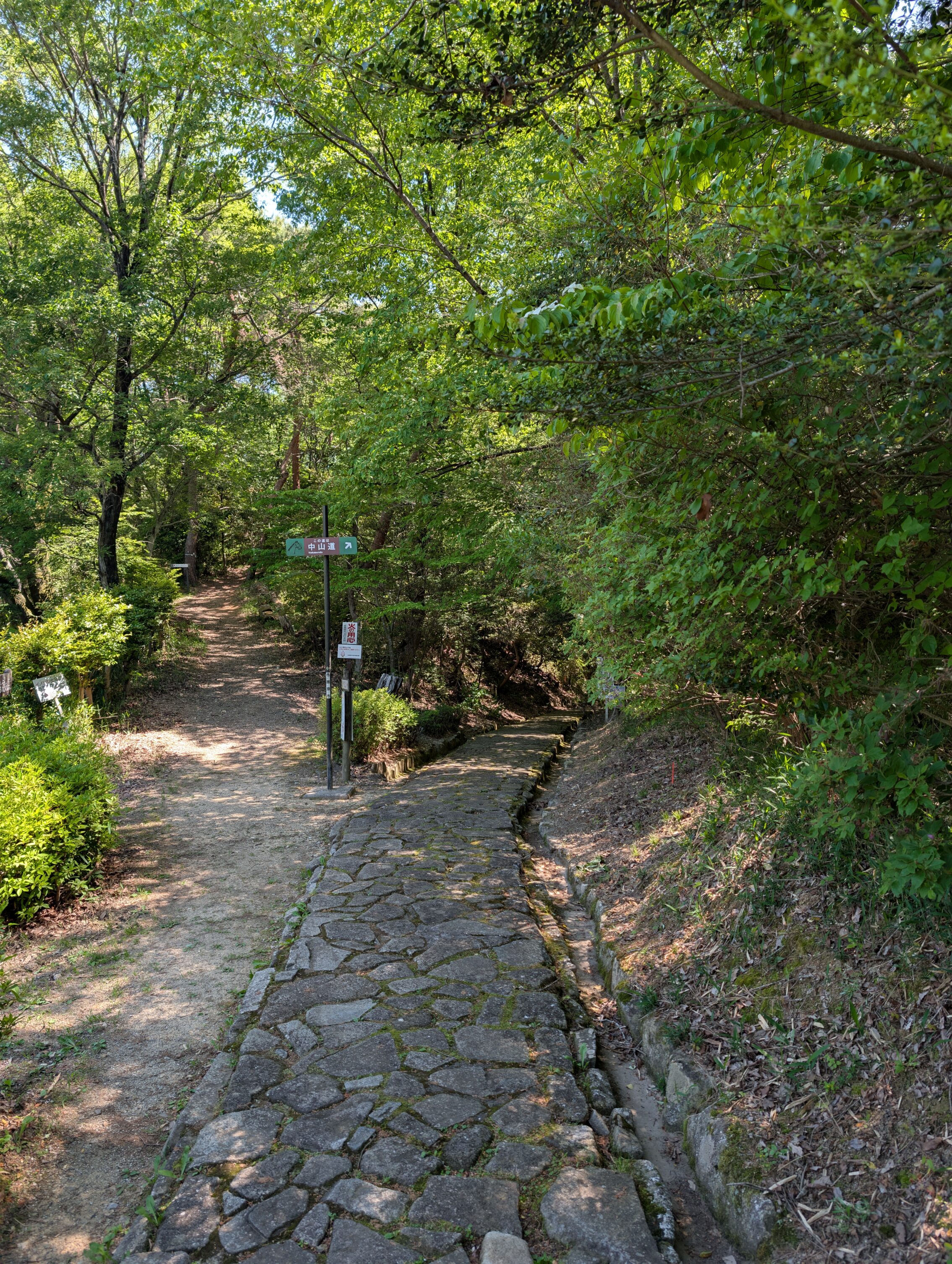
Further on up the hill, it is steep enough that people during the Edo period laid down ishidatami cobblestones.
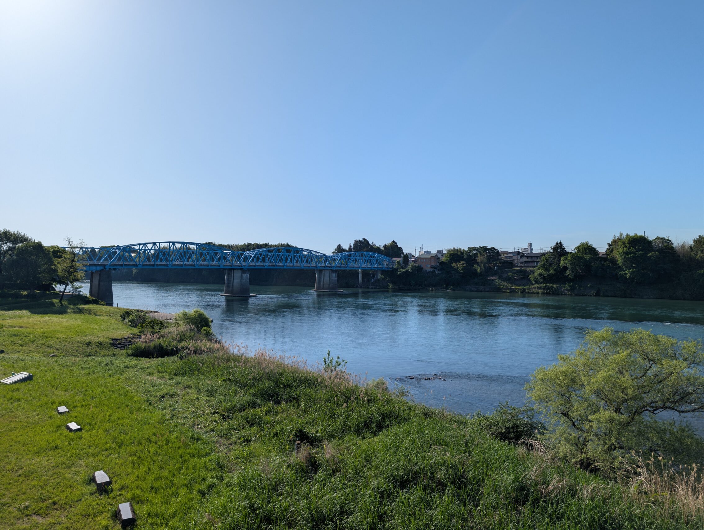
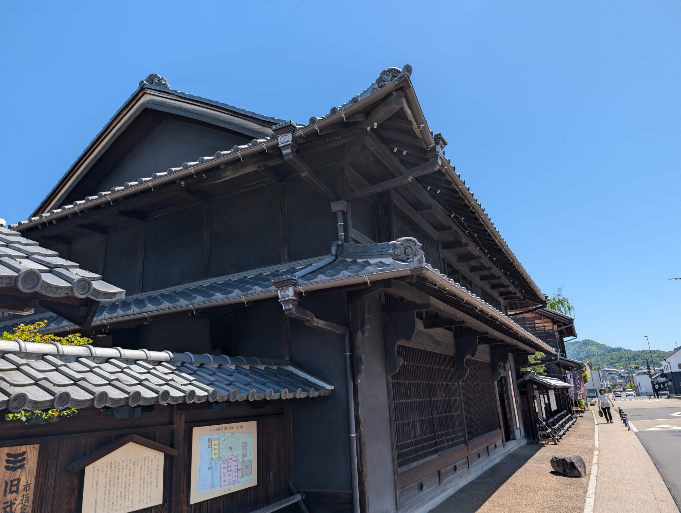
Unuma-juku also has a number of thriving Edo period houses acting as museums and open shops. It is quite worthwhile to stop here for a while to check out the various gardens and houses on display. They have done a lot of work to try and evoke a better feeling of the old post town, such as burying electrical cables near the centre, and restoring a lot of the old houses to their original design.
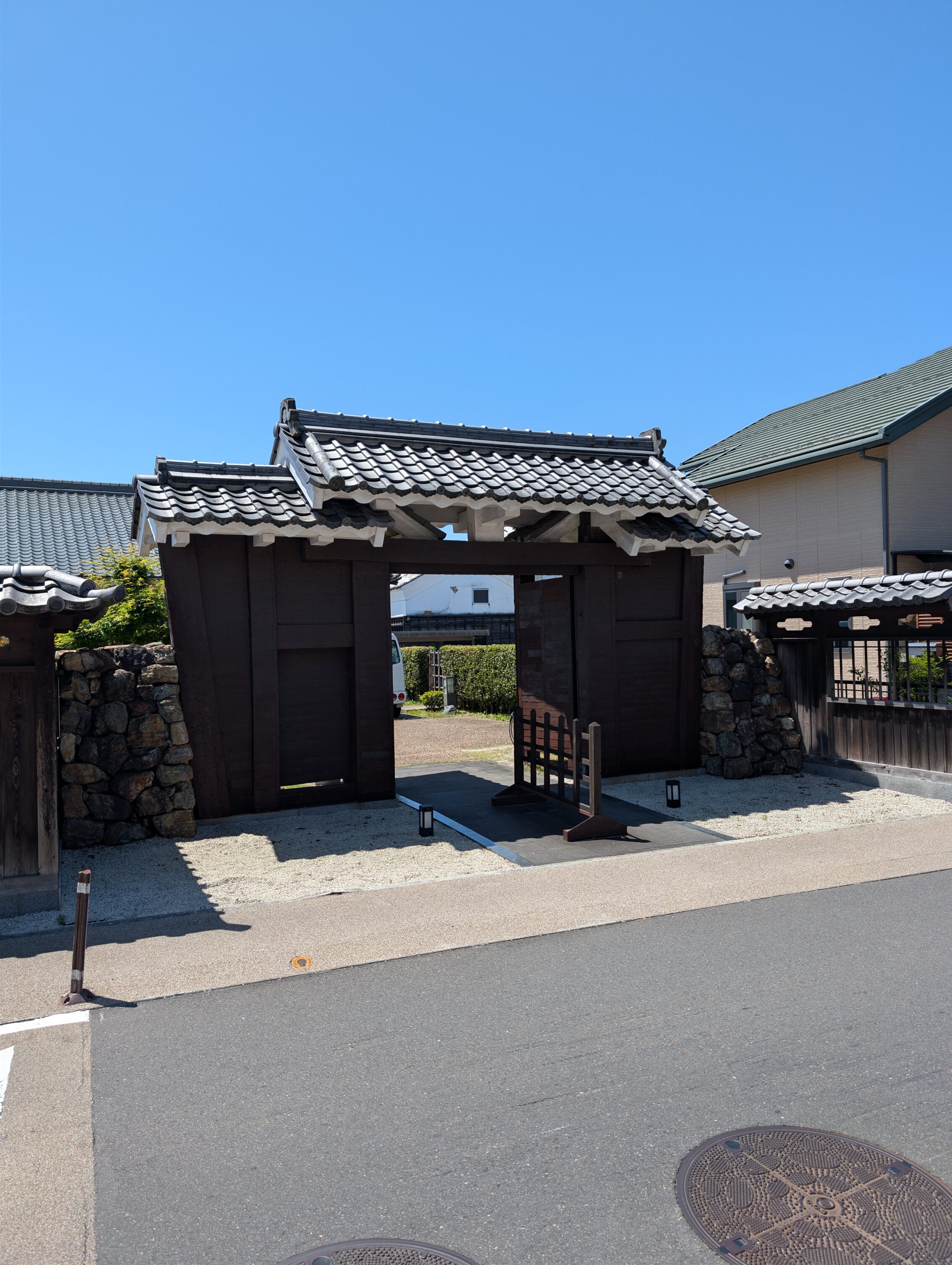
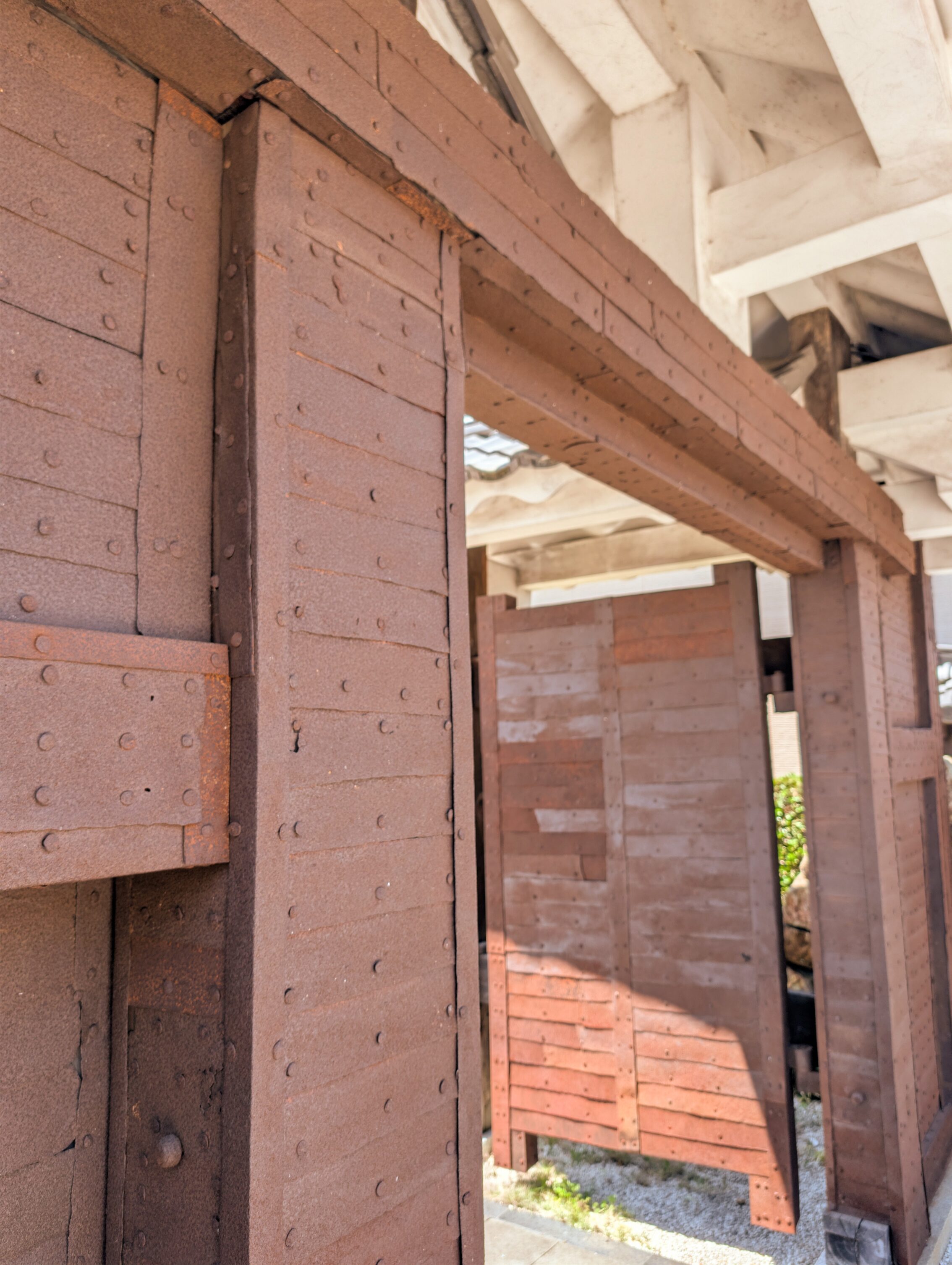
They have also saved the old metal gate from the Ogaki castle, and it is now on display in the shukuba.
The final stretch of the day was along the National Route 21. It wasn’t pretty or quaint, but at least it was monotonous and dull. And sometimes dangerous as the pavement just ceased to be at certain points. Yay.
There was a lot of variations to the milestones passed today.
The Kofurui ichirizuka is commemorated with a simple wooden post, in the backyard of what looks like an office building from the 90s. It is right by the embankment near Ōta-juku though, so there are beautiful views just a few steps away.
The Katsuyama ichirizuka is also just a simple wooden post, but it feels even more neglected. It’s just by a rather trafficked road, and the text is so faded that it’s almost illegible.
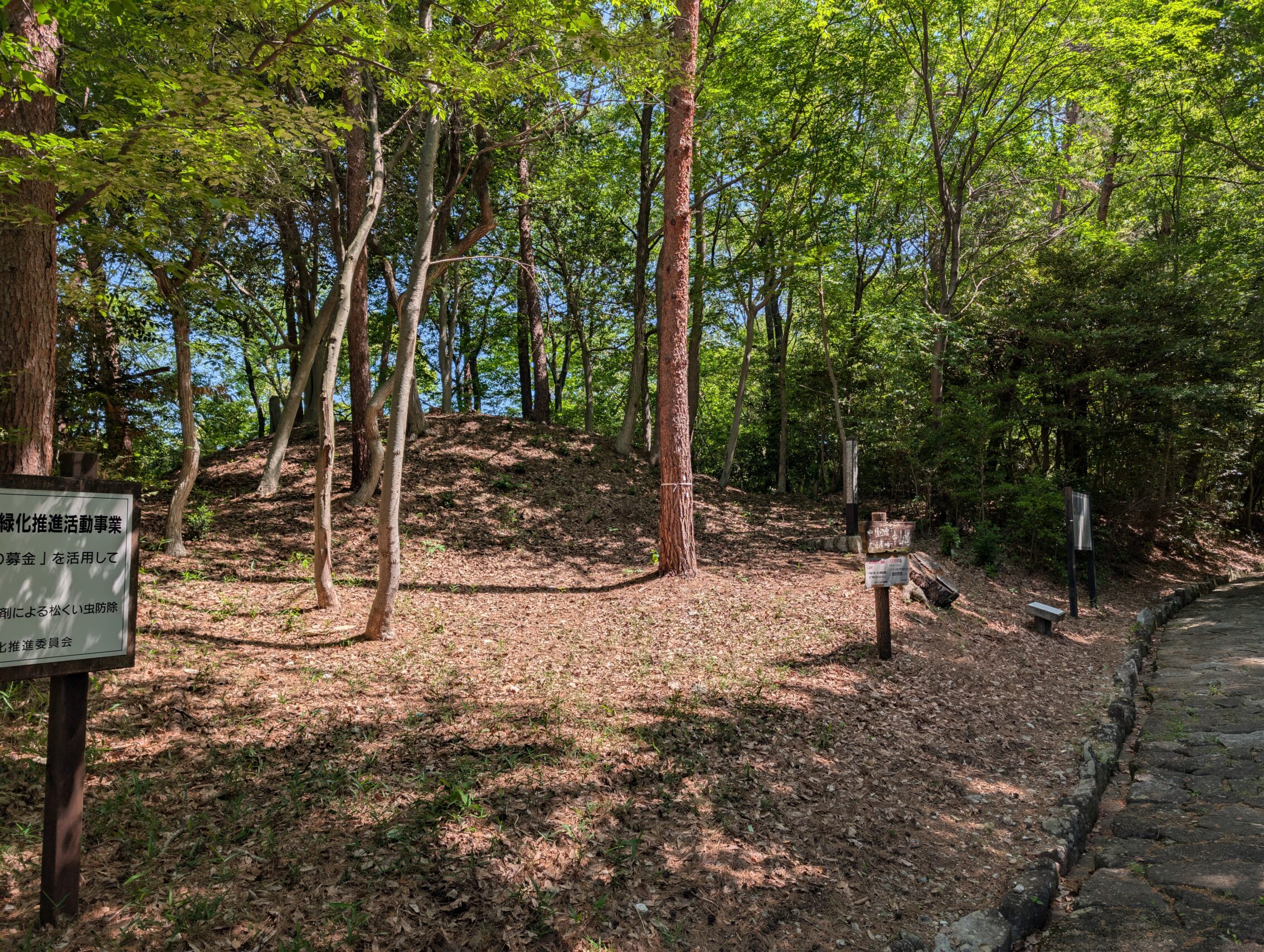
The Uto pass ichirizuka has the north mound mostly intact, and there are what can be traces of the southern mound as well. It is literally at the top of the Uto pass, where the restored cobblestones are, so it’s easy to get an old-timey feeling around it.
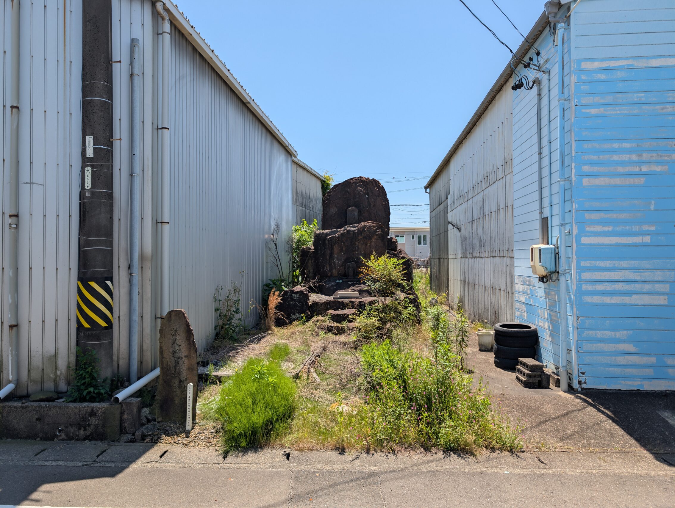
The Yamanomae ichirizuka is not only completely gone, as the remaining mound was used to fill in the hole of an exploded allied bomb in 1945, it has some of the most depressing surroundings of them all, The milestone marker is wedged in between two dilapidated warehouse buildings, in the shadow of a National Route 21 flyover. The dingy backalley also houses what used to be an impressive shrine of some kind, but now the whole place feels abandoned, with weeds all over the place.
The Rokuken ichirizuka is the final milestone of the day, and it too just has a wooden milestone marker, but it is rather new and it has been placed so it can easily be seen.
Distance according to the map: 20.8 km
Whereas the app claims: 22.9 km.


Leave a Reply