This day the hike didn’t go along the classical Nakasendō from Shimosuwa towards Shiojiri, but followed what is known as the Early Nakasendō. At the very start of the Tokugawa regime after the battles of Sekigahara in 1600, they started to institute the five main roads, the gokaidō, with the Nakasendō being one of them. The architect behind this road, Nagayasu, didn’t invent the path completely from scratch but used several older roads as a basis, such as the ancient Tōsandō, and others. One of the passages that were chosen went from Shimosuwa-shuku, by the Suwa lake over the Ono pass to Ono-juku and the Ono river, and then across the Ushiku pass down into the Narai river valley, at what is today known as the ai-no-shuku Sakurazawa. The path then headed south upstreams along the Narai towards Niekawa-shuku. This was the decided route in 1603 when all the warlords and opposition swore fealty to Tokugawa Ieasu.
This layout of the path didn’t last very long, however. Already in 1614, powerful political forces, and the fact that the originator had fallen out of favour with the Tokugawa regime factored in to instigate a change in the layout. The path was changed to head north out of the Narai valley and then to round the hills to cross the Shiojiri pass down into Shimosuwa instead. Ono-juku was discarded as a post town on the Nakasendō, and instead the post towns of Shiojiri, Seba and Motoyama were created instead. In recent years there have been a few attempts to revive interest in this forgotten stretch of Nakasendō history, so there are signs along the way, and the old milestones have (mostly) been given information signs and so on.
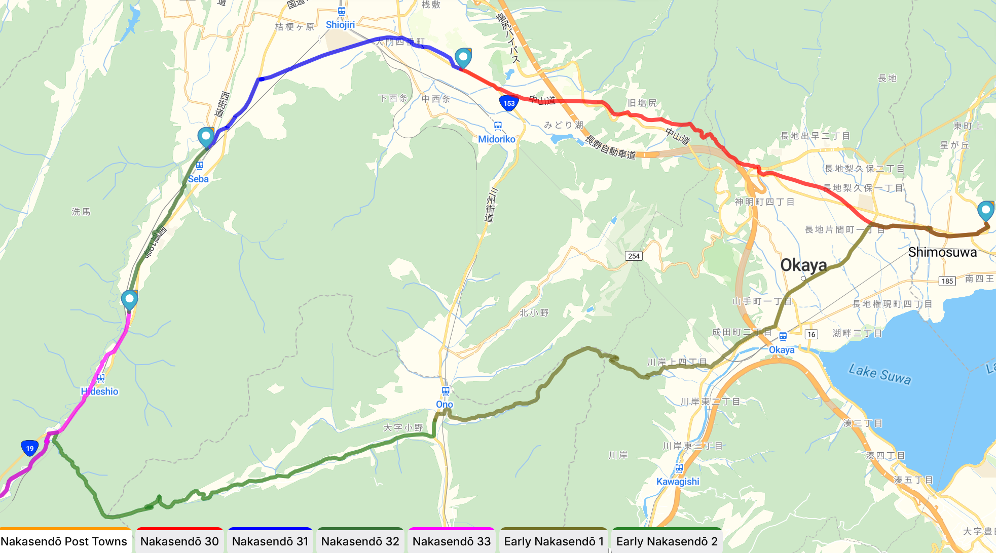
The Early Nakasendō had two mountain passes to cross, the Ono pass and the Ukisho pass, and both of these are just about as hard as the Shiojiri pass. In this respect the newer layout was better for the travellers of old.
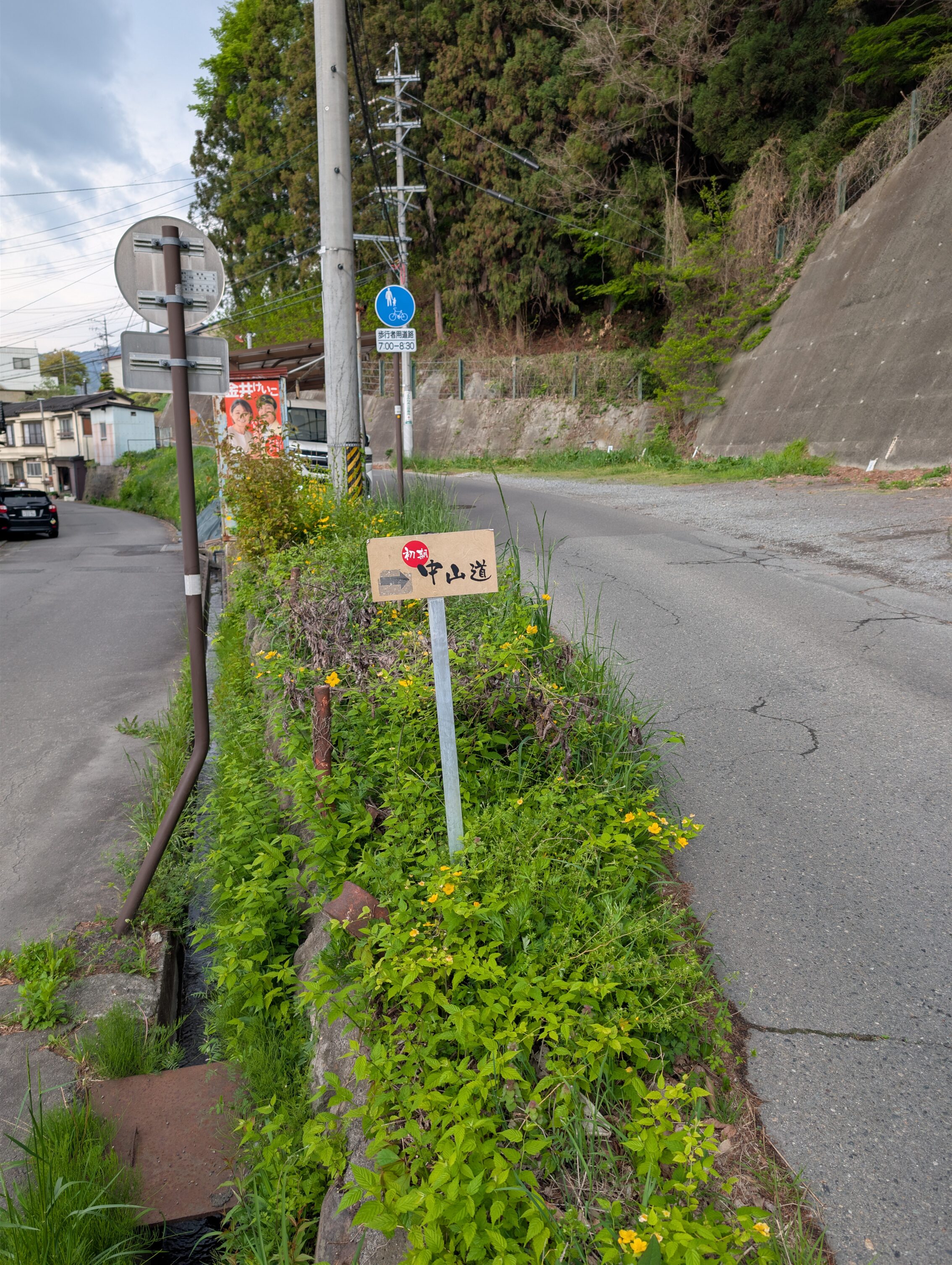
When hiking along first leg, the Early Nakasendō 1 as it’s labelled on the map, the first stretch goes through Shimosuwa and Okaya. This part is just hiking through an uncaring city that has no idea that you are a cool person reliving history. Anyway. There are no signs for the Early Nakasendō at all this stage of the leg, and the former ichirizuka that ought to have been somewhere among the houses is completely lost to history. The second ichirizuka which is a bit up the hill as you start leaving Okaya still has a mound left, and there are signs here as well. This wouldn’t be a kind of Nakasendō hike if the signs along the legs didn’t differ immensely, and the Early Nakasendō follows suit. The most common ones looked like this.
It was this sign, about six kilometres in on the first leg towards Ono-juku where the hilly parts started. The steepest section up towards the Ono pass was a gravel road in the deep forest, that was about 1.3 kilometres long and had an average incline of about 16%. It was rather tough going. But I got to see the Japanese Serow around this part! (See the other post about Moar Wildlife). After crossing the pass, the path again joined a paved road downhill all the way to Ono-juku. The road was wide and well maintained, but practically no cars passed me at all along those last four kilometres going downhill. I had the road almost all to myself which was very nice!
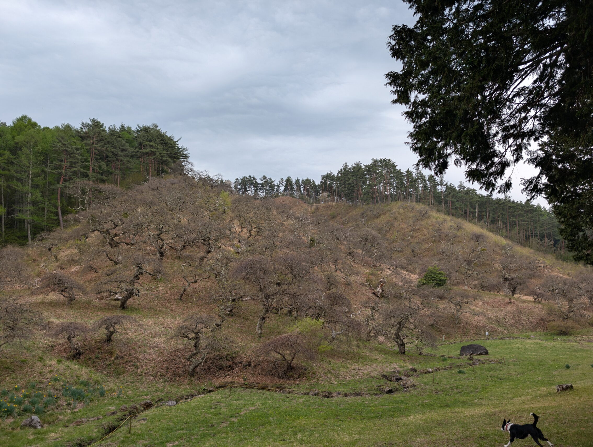
Up in the mountains there is a natural orchard of a special sub-species of the weeping chestnut tree (Castenea crenata var. pendula makino), where over 900 of them grow on their own. This is a protected park nowadays.
Ono-juku still survived as it was situated on the so called Salt Road, the Shio no Michi, that ran in a north-south direction. It has a handful of late 18th century houses left, but the road going through it in the old salt road direction is pretty busy, so it’s rather uncharming.
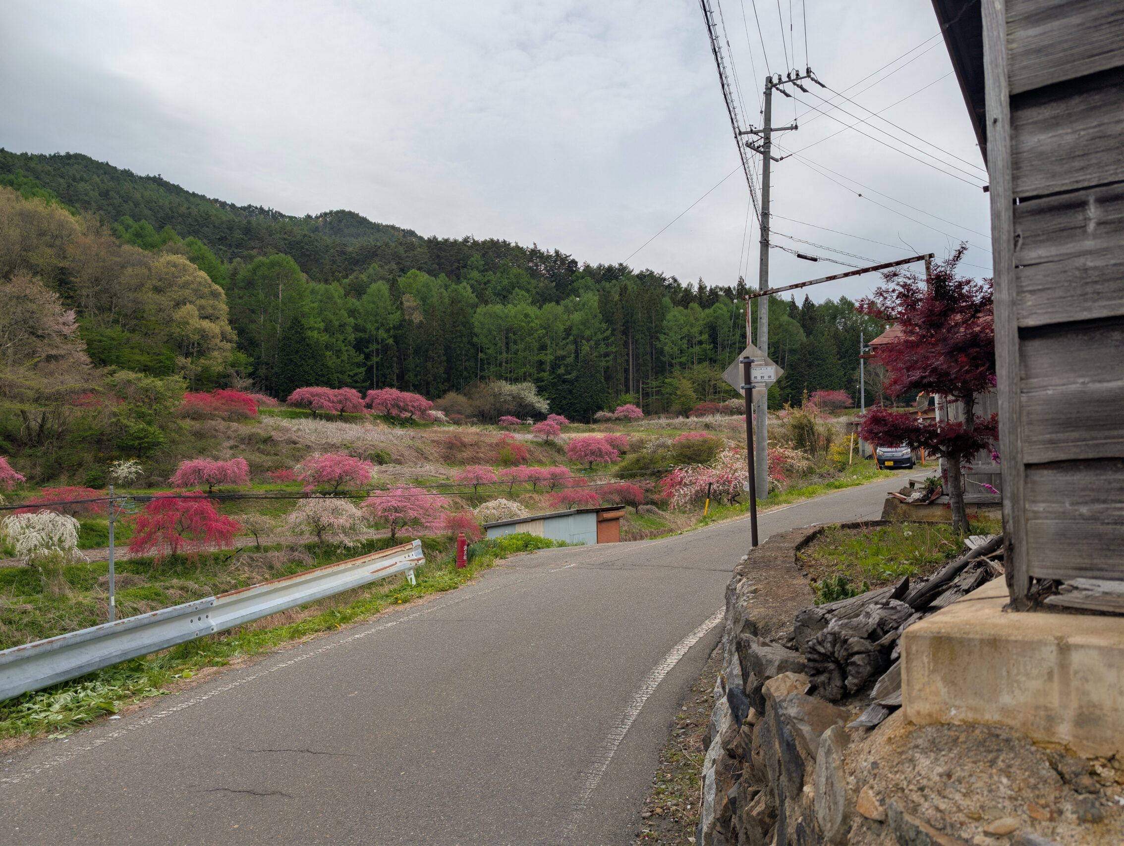
As you leave Ono-juku it starts going uphill again almost immediately. The village of Shimomura is stretched along the tiny road heading up towards the Ushiko pass, and this place is rather famous for growing various kinds of flowering trees. It calls itself the Weeping Peach village. I suppose if the opposing side of the valley has weeping chestnuts, this side has to have something weeping too. I hiked at the exact right time though, as the village fields looked just like their brochures!
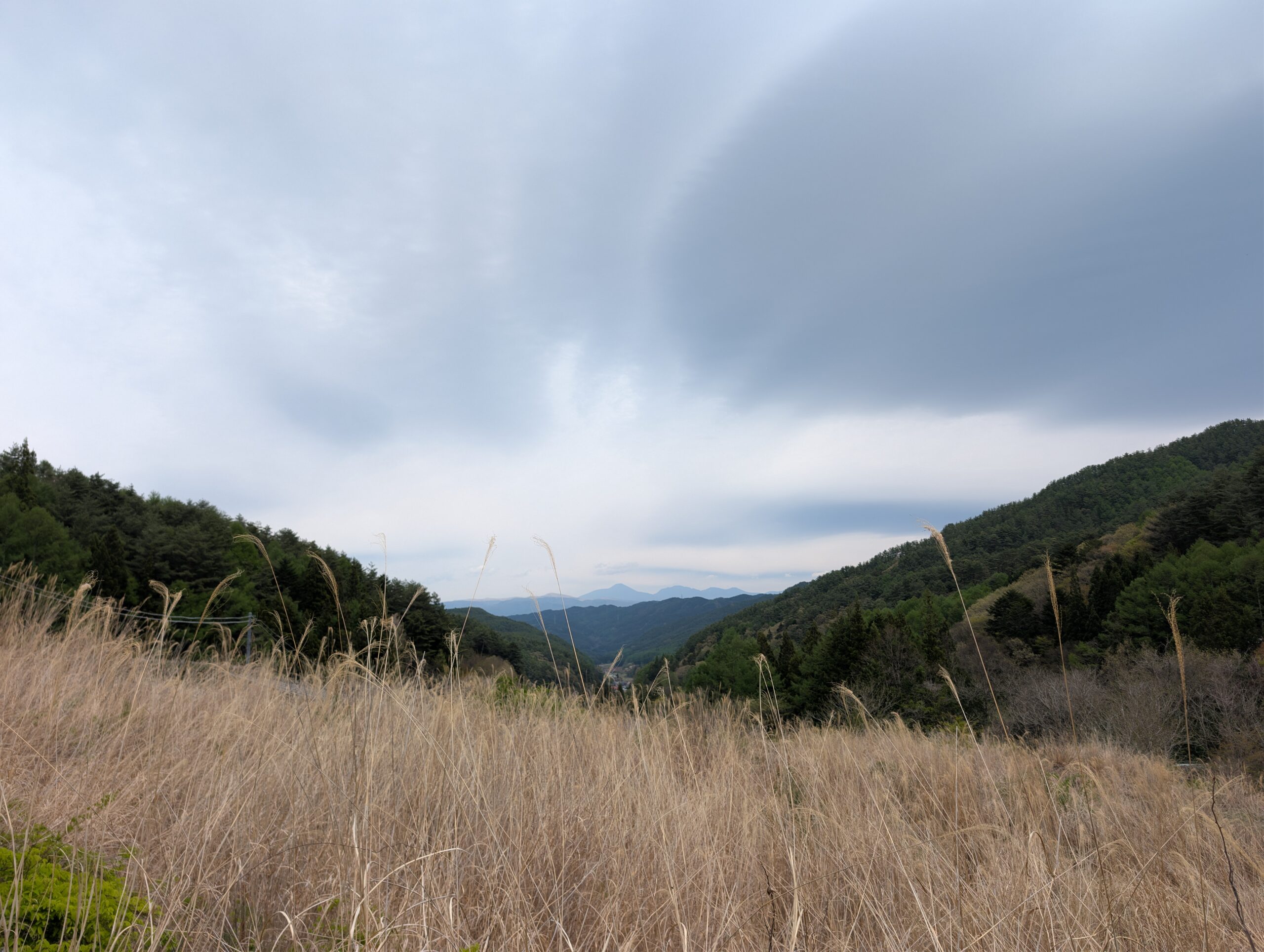
After leaving the crappy indie band behind the road turned even narrower, if that is even possible, and this is where I encountered snek! Make sure you see the snek! post! And just before the pass was the spectacular view that you can see in the featured post at the top of the page.
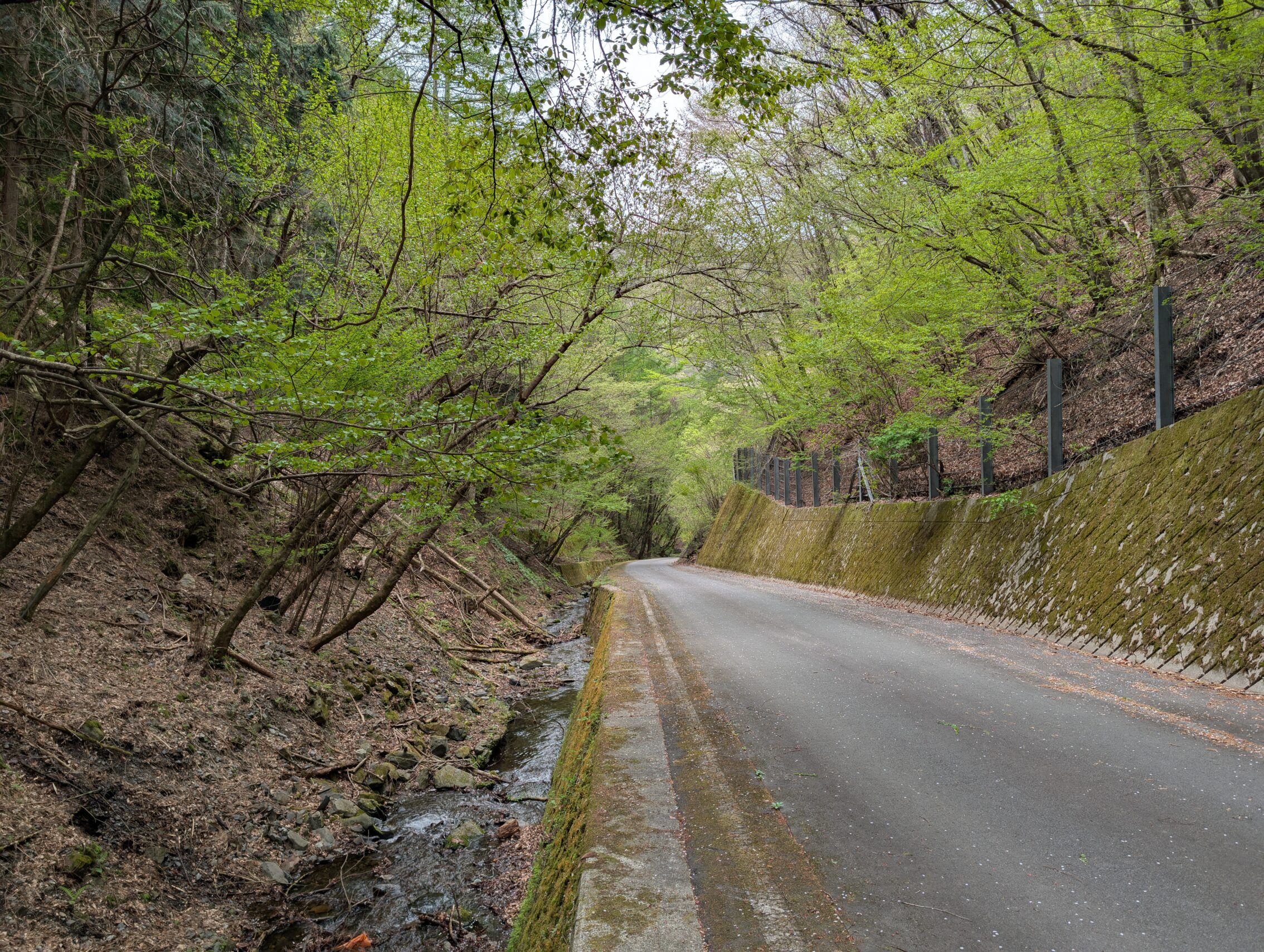
After the pass the road turned much steeper again down towards the Narai river valley. It’s difficult to get a sense of how steep something is using only a phone camera, but the road ahead below has a gradient of about 14%. And no, there are absolutely no protective railings here.
The Early Nakasendō ends just outside the small village Sakurazawa which was an ai-no-shuku during the Edo period. I’ll pass through that in a couple of days, as it houses a fundamental part of the history of the Nakasendō.
Milestones along the way
Unknown ichirizuka, probably near the Yokokawa river.
The Misawa ichirizuka has one mound left, and a host of information boards.
The Nirezawa ichirizuka is to the side of the modern road, but has both mounds intact!
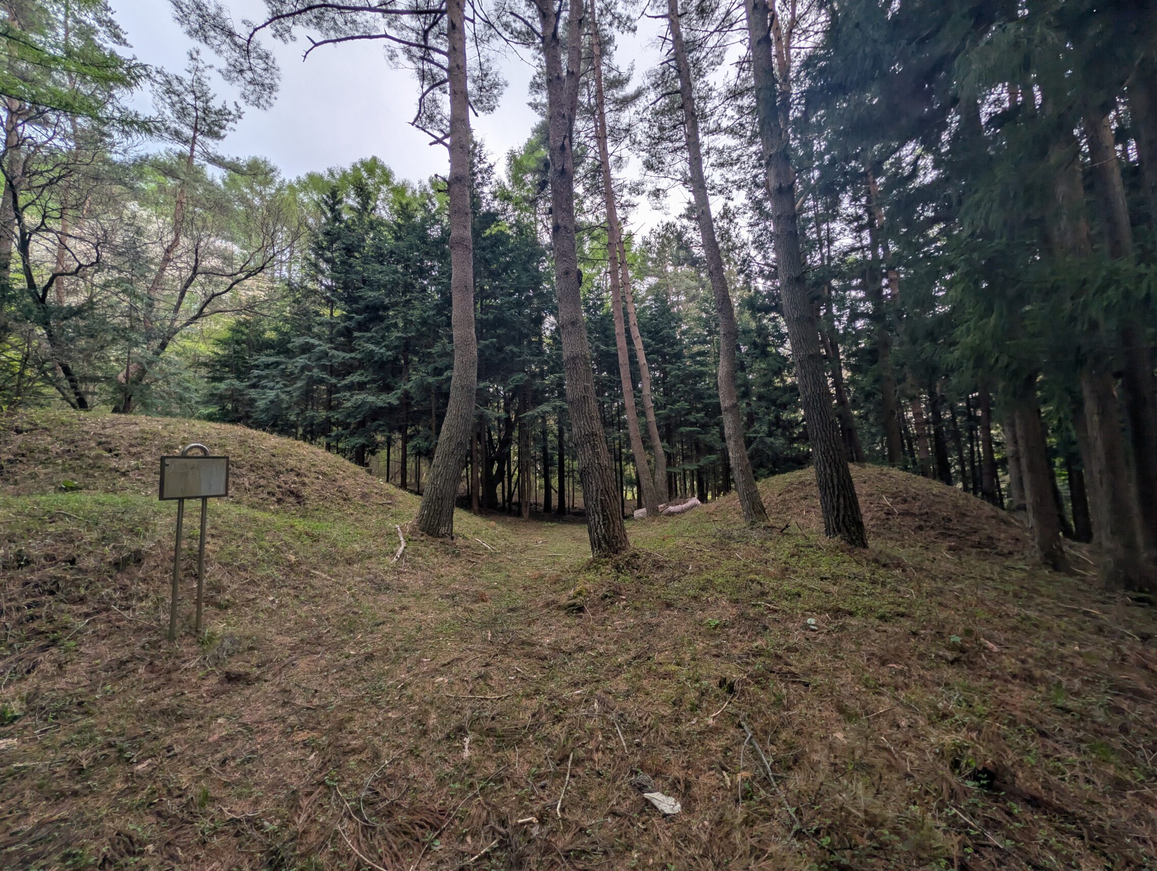
The Iinuma Tsukahara ichirizuka has a large stone marker.
The Maeyama ichirizuka has a smaller stone marker. Yes, it’s a competition.
Planned distance to hike according to the map: 26.5 kilometres.
Distance according to the app: 28.8 km.


Leave a Reply